My Search For Alpine, Washington
Introduction
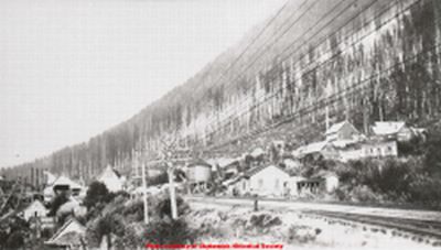
The storied ghost town of Alpine, Washington lay hidden in the second-growth forest of Washington's Cascade Mountains for 80 years on the northern slope of a ridge that extends from Mt Sawyer. Only in the last 4 years has Alpine been found again, and we have begun to map the remaining ruins. Alpine, Washington was abandoned in 1929; the buildings are gone, but we have so far found the foundations of the mill, the school, the social hall (built as the "Victory Hall" during World War I), the boarding house (which also housed the company offices and the post office, according to a 1926 map of Alpine), and 10 other buildings, some identified, some not. Our exploration of the site has covered only about 50% of the town; there is much yet to be found. 30 of us have participated in the exploration of the site, and 3 others have done substantial research to support the exploration of a place they may never see.
This web site will continue to grow as I add information, and, especially, photos. 8 photographers have contributed to this site, and there are external links to the photos of 3 other photographers. There remain several hundred photos for me to select from, and more have been taken that aren't yet available to me. At this moment (January 25, 2012) the story on this web site is many months behind actual events. This project has grown far beyond what it was intended to be. I originally intended to walk through Alpine and keep on walking; but this town and the ghosts of the memories of its people has seized me and not yet allowed me to go. This web site has become an online book, the equivalent of 150 paperback pages, with more than 100 external links to web sites that have information about Alpine, or to tangential eclectic sites that have information that may or may not interest someone who is looking for the definitive Alpine web site, but which have stories that are somehow linked. The story includes ghost towns, eerie events, and cemeteries. It also includes a history of the town and of its founder, Carl Lane Clemans, and more than a few mentions of history at Stanford University. It includes some of the adventures and misadventures of those of us who have tried and are trying to learn the forgotten story of this once thriving town.
The laughter of children once echoed in the Carroll Creek Valley in the middle of Alpine. At least 3 of those children were still alive in 2009, more than 80 years old. They have shared memories of Alpine with us, and given us information that we could never have known otherwise. It was more than a year after I began the search for Alpine that I met the first of these Alpiners. We had found 3, but we lost Bob Crawford on October 31, 2009. I hope there may be more Alpiners still alive who can tell us about the town they lived in, but we have only found 3. Nancy Cleveland and Anne Sekor have recorded the memories of these Alpine pioneers for posterity.
There are more than 50 photos on this web site. Most photos link to other pages and additional information if you just click on the photo.
I am still learning about Alpine, and I want to know more. If you have Alpine information, and are willing to share it, please contact me at tim@abarim.com. If you know someone who lived in Alpine, or someone who is the child or grandchild of someone who lived in Alpine, please contact me. Each has a story, and we would like to add those stories to the history of Alpine.
Some chapters of this site won't interest everyone. In fact probably no one will be interested in everything on the site. Not every chapter is directly about Alpine; some are about locations (such as Wellington) that are near by. Skip around to find what interests you. Look at the photos and click to the links from the photos. The chapter titles will give a clue to what in that chapter may interest each visitor. This isn't a book that must be read from beginning to end. Many of the chapters are still under construction and information is added as I find the time. Visitors point out errors, lost web links, and typos.
The owners of the 80 acres that encompass the ghost town of Alpine, Washington will have the final say; it is their property; but it is my hope that what is left of the little town of Alpine, Washington may be preserved and turned into an interpretive site that may be enjoyed by everyone. There is no formal organization to this end, but, in addition to the people who have participated in the exploration, dozens of people have contributed small amounts of money that has been used for some tools and gloves for the clearing operation, and for photocopying fragile records of events and irreplaceable photographs. The history of Alpine may not be complete. A number of us have begun to dream that we may preserve the remaining foundations and create a maze of gentle trails and information stations on the site of Alpine. The next or so will determine whether this will be a reality or just a pipe dream. A project of this size will cost a lot of money and require organization and a great deal of volunteer labor. If this interests you, I can be contacted at tim@abarim.com or at my work phone number 425 670 8167.
Also check out Matt Cawby's Alpine blog. And we now have a group in Yahoo Groups at http://groups.yahoo.com/group/AlpineWashington/
Several photos have been posted on the group site that aren't on this site, including an aerial photo of Alpine in 1930. There are also photos at the new FaceBook page http://www.facebook.com/pages/Alpine-WA/279532278821165
Avalanche
An avalanche blocked my path. The lower Iron Goat Trail, near Stevens Pass, Washington, was covered to a depth of more than 20 feet by snow, boulders, shattered trees, and the debris that an avalanche picks up as it roars down a mountainside. There were footprints in the snow. Someone had been foolish enough, or brave enough, to climb over the avalanche. My car was parked 2.5 miles behind me at the Martin Creek Trailhead; I had no incentive to climb over the avalanche and no desire to risk it. Nearly hidden under the avalanche was the concrete backwall of an old snowshed. The shed itself had long since rotted away and collapsed under the weight of 80 winters of neglect. Only the concrete backwall of the snowshed remained. The location of the avalanche that morning is a known avalanche chute, along a route that once was the Great Northern Railway. One hundred years ago the railroad had built a series of showsheds to protect the line from just this sort of accident. All but one of the snowsheds is now gone. The concrete backwalls stand as evidence of what was once there.
The avalanche had roared down the
southwest slope of Windy Peak, probably the deadliest mountain for avalanches in
the country, covering both the upper and lower Iron Goat Trails. Far more than 100 people
have died in avalanches on Windy Peak, most on what is now the upper Iron Goat Trail. Many of those lives were
lost when the railroad was operating, and the railroad hadn't used this route
since 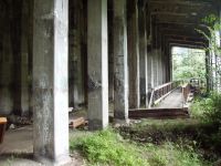 early 1929 when the "new" 8-mile Cascade Tunnel had opened. But, over the
years, cross-country skiers, snowmobilers, and hikers had been at risk when
traveling in the shadow of Windy Peak. On this day I didn't think I was at risk
and I didn't expect an avalanche. It was a little past noon on the 31st of May,
2008. It was nearly summer and the air temperature was about 60 degrees. I don't
know how much earlier the avalanche had descended, and I hadn't heard
any roar. But it was a warning. This can be dangerous country, very dangerous in
Winter, but risky at all times of year.
early 1929 when the "new" 8-mile Cascade Tunnel had opened. But, over the
years, cross-country skiers, snowmobilers, and hikers had been at risk when
traveling in the shadow of Windy Peak. On this day I didn't think I was at risk
and I didn't expect an avalanche. It was a little past noon on the 31st of May,
2008. It was nearly summer and the air temperature was about 60 degrees. I don't
know how much earlier the avalanche had descended, and I hadn't heard
any roar. But it was a warning. This can be dangerous country, very dangerous in
Winter, but risky at all times of year.
It was another avalanche that had first interested me in this place. That earlier avalanche, the most deadly in U.S. history, struck the small town of Wellington, Washington in the very early morning of March 1, 1910. According to the official records, 96 people died in that avalanche when 2 Great Northern Railway trains, rotary snowplows, electric engines, and the Cascade Division Superintendent's personal cars were swept into the Tye River 150 feet below Wellington. It was the worst loss of life in a railroad disaster up to that time. Bob Kelly has a fine web site about the Wellington Avalanche at http://myplace.frontier.com/~mvmmvm/ In 2007 Gary Krist wrote an outstanding book, "The White Cascade", about the Wellington Avalanche. In 2009 Martin Burwash wrote "Vis Major", a novel, but a novel that stays very close to the real history, and the real people of the Wellington Avalanche. The Iron Goat Trail now follows the route of the old Great Northern Railway for 9 miles from the old Cascade Tunnel at what once was the town of Wellington, west of Stevens Pass, Washington, to Scenic Hot Springs. In its 9 miles the Iron Goat Trail has an elevation gain of 1000 feet.
 I first learned about the Wellington disaster from a small
entry in the 1958 World Almanac. I was 11 years old. For years I didn't learn
anything more. I didn't even know exactly where Wellington might have been. The
Great Northern Railway had renamed the depot as Tye, to erase the memory of the
disaster, and abandoned that route completely in 1929. The grandfather of one of
my high school friends had lived in Tye for 3 years while working on the "new" 8
mile Cascade Tunnel from 1926 to 1929. He had never heard of Wellington although
he lived in it or near it for 3 years. From the Stevens Pass Highway I could see
what I now know to have been snowsheds that have gradually collapsed over the years.
It was 2001 before I learned the exact location of Wellington. It was 2006
before I visited Wellington for the first time, and walked the upper Iron Goat Trail.
I first learned about the Wellington disaster from a small
entry in the 1958 World Almanac. I was 11 years old. For years I didn't learn
anything more. I didn't even know exactly where Wellington might have been. The
Great Northern Railway had renamed the depot as Tye, to erase the memory of the
disaster, and abandoned that route completely in 1929. The grandfather of one of
my high school friends had lived in Tye for 3 years while working on the "new" 8
mile Cascade Tunnel from 1926 to 1929. He had never heard of Wellington although
he lived in it or near it for 3 years. From the Stevens Pass Highway I could see
what I now know to have been snowsheds that have gradually collapsed over the years.
It was 2001 before I learned the exact location of Wellington. It was 2006
before I visited Wellington for the first time, and walked the upper Iron Goat Trail.
This day in May 2008 was my first walk on the lower Iron Goat Trail. I had walked parts of the upper trail 6 or 7 times, but this morning I had decided to walk the lower trail from Martin Creek to the parking lot at the Windy Point trailhead near Scenic Hot Springs. Blocked by the avalanche, I turned back to walk the 2.5 miles to my car. It hadn't been a useless day. I had seen the famous Twin Tunnels of the lower trail, and I had visited the site of Corea, once a stop on the Great Northern Railway. Near Corea 3 original telegraph poles still stood, having survived 80 Cascade Mountain winters.
As I walked back to my car I thought about the trail and the
railroad. I had now visited every station location between Cascade Station and
Scenic. I had never really visited Scenic, but I had driven by it a hundred
times or more. I decided that I would visit every station back down from the
mountains to Puget Sound and my home in Edmonds. Scenic was nearby, but I was
hungry and I turned west toward Skykomish and the Cascadia Inn, where I would devour a
Cadia Burger. In June I intended to visit the tiny station at Scenic, still used by
the Burlington Northern Sante Fe Railroad, the successor to the Great Northern
Railway.
In June I did visit Scenic. It really isn't much of a place.
The hot springs have been closed for many years, and the old resort hotel has
been gone just about as long as the old railroad route. The owner of the hot springs has marked it "No Trespassing" - probably because of liability concerns. The only interest at
Scenic is that a train is often waiting for its turn to go through the "new" 7.8
mile Cascade Tunnel. It takes a while for the tunnel to clear of exhaust gases
from the diesel engines. Powerful fans at the Berne (east) entrance to the
tunnel expel the exhaust fumes. Otherwise the tunnel could be a dangerous place
to travel. The original 3 mile tunnel from Cascade Station to Wellington had
been dangerous in the era of steam engines, and some trainmen (and probably a hobo or two) had been
asphyxiated by the noxious fumes of coal-burning steam engines. Great Northern had electrified the original tunnel in 1909. Electric
engines pulled the trains through the tunnel - then steam would take over again.
The "new" tunnel had been electrified until July 31, 1956. On that day #5018 made the last electrified trip through the tunnel.
Now, for more than 50 years, diesels have carried the load. Often 5 or 6 diesel engines pull a train up the slope and through the Cascade Mountains. Diesels are more efficient for the railroad because it is no longer necessary to waste time coupling electric engines into and out of trains to move through the mountains, and extra train crews at Skykomish and Leavenworth are no longer necessary. The longer tunnel saved the railroad time and money, and it avoided the most dangerous stretch of railroad. The "new" tunnel is nearly 1000 feet lower than the old tunnel. The hazard of snow is greatly reduced by the "new" tunnel, and the hazard of avalanche is almost non-existent.
Corea in May. Scenic in June. In July it would be Alpine. Or would it? First I had to find Alpine. Every old Great Northern station site that I had visited had either been close to Highway 2, which is the Stevens Pass Highway, or on the Iron Goat Trail. Alpine was neither. In fact Alpine didn't seem to be anywhere. The town of Alpine was bigger than any of the other towns and stations that I had visited. Alpine was the biggest town on the Great Northern Railway in the 50 miles between Leavenworth and Skykomish. Skykomish still survives, and Leavenworth thrives despite the loss of the railroad. Alpine didn't survive. It was too high, and too remote, and too far off the highway when the common mode of transportation changed from railroads to highways in the 1920s. Few of us now will drive a mile off the interstate. In 1929 almost no one would drive one mile from the highway and an elevation gain of 500 feet. Alpine died and its location was lost for 80 years.
In 1924 Alpine had been the last town of the "passable highway". On October 31, 1924 the first car to drive over Stevens Pass reached Alpine where is was winched up to the railroad tracks by the Alpine mill. From there the car drove on the railroad ties to Tye and then along the old railroad switchbacks to the Stevens Pass summit. 1 By July 1925 the Stevens Pass Scenic Highway was open and Alpine was a mile off the highway, and within 4 years Alpine had been abandoned. The ghost town of Alpine was somewhere along the present-day BNSF railroad line, but there was apparently no longer a road into the town. The prospect of walking 3 miles along the railroad to find what might not be there was a not very inviting prospect. I used up several weekends testing every road and cowtrail that might get close. No luck. I checked the internet. On the internet I found an interesting web site about Alpine by Patrick Burns, who had also tried to find Alpine, but he had no answer to its location. I had tried the same road he had tried, and, like him, found the prospect of walking the rails for 2 or 3 miles not to my liking.
Patrick Burns is Professor Emeritus at Valdosta State University in Valdosta, Georgia. Patrick is an Edmonds, Washington native, the same town I now call home, and in 2009 he moved back to Puget Sound, settling in Mukilteo. But at that time Pat was still living in Georgia. His web site, Alpine Pursuit introduced me for the first time to the work of Seattle author Mary Daheim. Daheim has written a series of mystery books that take place in the mythical town of Alpine, Washington. Except Daheim's Alpine isn't completely mythical. Mary Daheim's grandparents lived many years in Alpine. Mary's mother grew up in Alpine and her parents lived in Alpine during their early married life. Mary Daheim has brought the town of Alpine back to life in her Emma Lord series of mysteries. In the books, Emma Lord is the publisher of the Alpine Advocate newspaper in the town of Alpine that in some alternate universe has survived as a viable town to the present day, and is now the county seat of mythical Skykomish County, Washington. I was not in the habit of reading mysteries, or any fiction for that matter, and I had not heard of Mary Daheim or her books. I did send an email to Pat Burns in which I said, "I am glad there is at least one person in the world who is as big an idiot as I am." Pat didn't take offense, he understood what I meant about this strange obsession when one catches the "Alpine flu".
Apparently I was the only person in the Seattle area who didn't know Mary Daheim and had not read at least one book in the Alpine Advocate series. Jan Kavadas promptly dropped 3 books of the series on my desk to read. I read Alpine Journey and really didn't care for it. Maybe I didn't like Alpine Journey because it didn't happen in Alpine. Of all the books in the series, Alpine Journey has the least to do with Alpine. Alpine Journey doesn't even take place in Washington; almost the entire book takes place in Cannon Beach, Oregon, about as un-Alpine a place as you may find in the Pacific Northwest. A few weeks later, while visiting my friend Bill Longbrake, Bill told me that he, renamed for fiction as Bob Lambrecht, was one of the characters in book 6, Alpine Fury. I then borrowed and read Alpine Fury, and, partly because I could recognize Bill and one of the other characters, I enjoyed the book somewhat more. Fran Uchida, who loaned me Alpine Fury, and Martha Longbrake, Bill's wife and devoted Mary Daheim fan, both suggested that I would enjoy the books more if I started at the beginning with the Alpine Advocate, read through the series, and get to know the characters as they develop. I bought a copy of Alpine Advocate and started there. The advice was correct. Like the Yellow Brick Road it is usually best to start at the beginning. I began to enjoy the books, but this didn't get me any closer to finding Alpine. At the beginning of Alpine Advocate, Mary Daheim included in an Author's Note a brief description of the real Alpine and its founder Carl Lane Clemans, and dedicated the book. "To all those who lived the real Alpine story, and in the process, created a legend. These courageous men and women embodied the spirit of the Pacific Northwest." 2 I would later find that Clemans had been a remarkable man, better known for many things than just the founder of a small town in the Washington Cascades. Mary Daheim has almost single-handedly kept the name of Alpine alive for nearly 2 decades. Now it was up to me to find Alpine if it was really there to find. I was warned that there was little left of the town. The Wikipedia listing says that all that remains of Alpine are 2 cornerstones of the mill. Maybe that would be all that I would find, but by now I was determined to find it. If you have visited a rain forest you know how difficult it may be to find anything, even if you know that it is there. In the dry Southwest the buildings of a ghost town may linger for centuries; in the wet of a Pacific Northwest rain forest a town may rot away in a couple of generations. That was the challenge. What to do now?
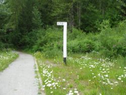 Bob Kelly, at the Skykomish
Museum, gave me a railroad milepost at 1723.5 (measured from the beginning
of the old Great Northern Railway in St Paul), but that was 2 miles from the
nearest way in to Alpine that I had found. In early August my daughter, Chrissy,
accompanied me on road searches. That she barely tolerated old dad's eccentricities
was more like it, and she went along because my daughters are always afraid that dad will drive off a road 50 miles from nowhere and the body won't be found until the next year. On the Foss River Road, just past where the road crosses the
Foss River on a one-lane bridge, was a road that looked promising, Forest
Service Road 6180. After traveling east less than 2 miles our journey on that
road came to an end at a "Private Property" sign. Many months later I learned
that this old, weary, poorly-maintained, dirt road has a story to tell.
According to King
County tax records, this old road, east from Foss River, is the original
Stevens Pass Scenic Highway, abandoned by Washington State in 1940. Bob Kelly
says that oldtimers in Skykomish remembered driving that road to dances in
Alpine. But for me the road no longer went as far as Alpine. Too bad. Chrissy
and I climbed up the slope next to the Foss River trestle. The railroad milepost
read 1728.2 - we wouldn't get into Alpine from there. I didn't know that help
was nearby, virtually in the noon shadow of the Foss River trestle in the form
of Pat Casey, the Foss River Hermit. I wouldn't meet Pat for another month.
Bob Kelly, at the Skykomish
Museum, gave me a railroad milepost at 1723.5 (measured from the beginning
of the old Great Northern Railway in St Paul), but that was 2 miles from the
nearest way in to Alpine that I had found. In early August my daughter, Chrissy,
accompanied me on road searches. That she barely tolerated old dad's eccentricities
was more like it, and she went along because my daughters are always afraid that dad will drive off a road 50 miles from nowhere and the body won't be found until the next year. On the Foss River Road, just past where the road crosses the
Foss River on a one-lane bridge, was a road that looked promising, Forest
Service Road 6180. After traveling east less than 2 miles our journey on that
road came to an end at a "Private Property" sign. Many months later I learned
that this old, weary, poorly-maintained, dirt road has a story to tell.
According to King
County tax records, this old road, east from Foss River, is the original
Stevens Pass Scenic Highway, abandoned by Washington State in 1940. Bob Kelly
says that oldtimers in Skykomish remembered driving that road to dances in
Alpine. But for me the road no longer went as far as Alpine. Too bad. Chrissy
and I climbed up the slope next to the Foss River trestle. The railroad milepost
read 1728.2 - we wouldn't get into Alpine from there. I didn't know that help
was nearby, virtually in the noon shadow of the Foss River trestle in the form
of Pat Casey, the Foss River Hermit. I wouldn't meet Pat for another month.
The Alpine depot had originally been named Nippon. Japanese railroad workers may have lived in Nippon while the railroad was constructed in the early 1890s. Or the name Nippon may have been just another international name applied to the Great Northern Railway. James Hill, the "Empire Builder" as he was later known, believed that he could transport the goods of Asia and Europe across a North American railroad link. Goods could travel from Seattle to New York in days, instead of the weeks or months that it would take a ship to travel the distance. The Panama Canal didn't exist in 1890. European and Pacific names dotted the Great Northern Railway. In Washington there were Nippon, Tokio, Corea, Tonga, Berlin, Wellington, and Krupp. It is doubtful that the towns were inhabited by Japanese, Koreans, Polynesians, English, and Germans. It is more likely that the name was just a name in the worldwide vocabulary of the Great Northern. The name on the Nippon Depot wasn't changed to Alpine until 1914. The Post Office had called the town Alpine for postal purposes since the founding of the town in April 1910. Why, don't know? But Carl Clemans, acting as postmaster of Alpine, stated it well in a letter to M. J. Costello, traffic manager for the Great Northern Railway, when he said, "We would therefore respectfully request that the name of the station be changed to "Alpine" which on account of the character of the country seems a fitting appellation." 3 We do know that the Post Office declined the name of Nippon because there was already a Nippon Postal Office in Seattle. Maybe Carl Clemans had used the same reasoning in selecting the Alpine for the Post Office name when he discovered in 1910 that it couldn't be called Nippon.
Clemans was more than the postmaster of Alpine. Alpine was a company town and Carl Clemans ran the company. But the company town image that most of us envision apparently doesn't fit in the case of Alpine. Copies of several of the Alpine annual reports still exist at the Skykomish Museum. In those reports are the record of births, deaths, and marriages, the date of the last snow visible on Mount Baldy across the Tye River valley, the date of the first new snow on Baldy, and the usual company records that you would expect in an annual report. In those annual reports Mr Clemans seems to take great pride in the success of his former employees. He proudly talks about former employees who are now mill owners or lumber company owners themselves, or who have moved to other occupations in the city. There is a sense, almost, of a parent talking about his sons who have gone on and succeeded in the world.
The annual reports were given to attendees at the Alpine annual banquet. The name of the company remained the Nippon Lumber Company for many years after the depot was renamed Alpine, but in 1920 the name of the company itself was changed to the Alpine Lumber Company. Throughout the twenties the company, the depot, the post office, and the town itself went by the name of Alpine. Then the twenties ended and so did the town, almost lost to memory. I wanted to find Alpine, whatever little might remain. In a rain forest that might be little or nothing. I had gone looking for the town of Franklin in southeast King County a number of years ago and had found almost nothing. I might find almost nothing of Alpine, but once I had found it I could move on down the Tye and Sky River valleys to the locations of old Great Northern Railway stops at Tonga and Berlin/Miller River and Grotto and Baring and Halford and Heybrook.
August Visit to the Ghosts of Wellington and Cascade Station
On August 17, 2008 I temporarily abandoned my search for Alpine.
Melissa Logstrom accompanied me in a visit to 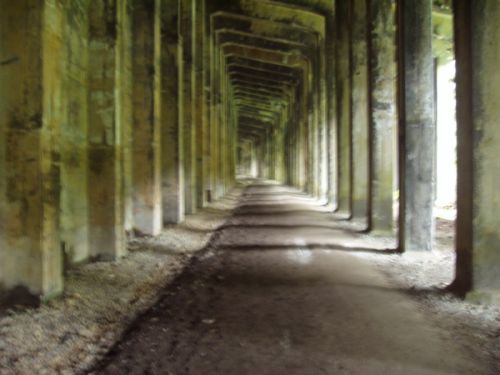 Wellington and Cascade Station.
Wellington was 12 railroad miles east of Alpine, and about 6 direct miles northeast of Alpine. Cascade Station was 3 miles further east. A railroad can't climb much more than 100 feet per mile. Alpine is at 1800 feet and Wellington is at 3000 feet. To get from Alpine to Wellington the Great Northern Railway needed 12 miles of track. To accomplish this the Great Northern installed a big curve at Scenic that turned the track back to the west. From Scenic the Great Northern went 3 miles to Martin Creek and turned back to the east in the "Horseshoe Tunnel". This added the additional 6 miles that the railroad required to gain the full elevation from Alpine to Wellington. For 3 miles the railroad went west to go east, but the railroad direction was always considered to be "east". The compass direction from Scenic to Corea, and then to Martin Creek, might be west by north, but the engineer and conductor understood the railroad directions that the route was always east.
Wellington and Cascade Station.
Wellington was 12 railroad miles east of Alpine, and about 6 direct miles northeast of Alpine. Cascade Station was 3 miles further east. A railroad can't climb much more than 100 feet per mile. Alpine is at 1800 feet and Wellington is at 3000 feet. To get from Alpine to Wellington the Great Northern Railway needed 12 miles of track. To accomplish this the Great Northern installed a big curve at Scenic that turned the track back to the west. From Scenic the Great Northern went 3 miles to Martin Creek and turned back to the east in the "Horseshoe Tunnel". This added the additional 6 miles that the railroad required to gain the full elevation from Alpine to Wellington. For 3 miles the railroad went west to go east, but the railroad direction was always considered to be "east". The compass direction from Scenic to Corea, and then to Martin Creek, might be west by north, but the engineer and conductor understood the railroad directions that the route was always east.
From 1893 to 1929 Wellington and Cascade Station had been the Great Northern Railway stations on either side of Stevens Pass. Wellington was the west station and Cascade Station was on the east. From 1893 to 1900 the two stations had been connected by a series of switchbacks. In 1900 a 3-mile tunnel under Stevens Pass was completed, sharply reducing the time between the two stations, but increasing the danger. Smoke from steam engines accumulated in the tunnel, making it nearly impossible to breathe. Heat built up in the engine cabs because there was no place for it to dissipate. An unknown number of train crewmen, and probably some hobos died of asphyxiation in the tunnel.
The Great Northern Railway had a reputation of being easy on hobos. Other railroads would treat hobos badly if they caught them. "What they said Jim Hill said, 'Bums built it, bums can ride it.' " 4 That Great Northern welcome mat for hobos may have ended badly for some in the heat and choking smoke of the old Cascade Tunnel.
On another occasion
"a train carrying over 100 passengers broke down in the tunnel. While attempting to fix the problem, The engineer, fireman, and conductor all succumbed to the fumes and collapsed. As the passenger cars slowly began to fill with gas, an off-duty fireman named Abbott, riding as a passenger, fought his way forward to the locomotive and released the brakes. The train proceeded to roll downgrade, gathering momentum until it shot backward out of the tunnel at Wellington. Abbott was still sentient enough to trigger the emergency brakes. The train screeched to a stop in the Wellington yard, its crew and most of its passengers unconscious but still very much alive" 5
The danger of the Cascade Tunnel finally forced the Great Northern Railway to invest in electric locomotives. The electrics went into service in July 1909. There were some problems. Sometimes an electric locomotive would fail and the steam locomotives would be pressed into service. Even so, the electrification of the Cascade Tunnel from Wellington to Cascade Station was a measurable improvement in safety and comfort for train crews and Great Northern passengers.
There is an irony in the suffocating smoke and hellish heat of
the Cascade Tunnel when used by steam 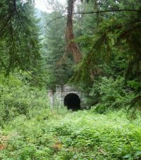 locomotives. I have entered the portals of
the
locomotives. I have entered the portals of
the 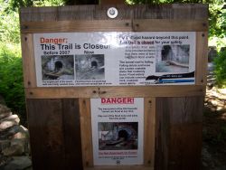 Cascade Tunnel about 10 times. I was never brave, or foolish, enough to walk
all the way through from Wellington to Cascade Station.
The tunnel always looked too dangerous and likely to fall down for my taste. The
tunnel is cold and wet and miserable, in stark contrast to the vision of
oppressive heat and smoke that accompanied steam locomotives. Water runs
continuously in the drainage ditches on either side of the old trackbed. The
tunnel roof finally did collapse near the Wellington end in the Spring of 2008,
and fencing prevents visitors from getting too close to the tunnel portal. It is
now subject to sudden releases of water from behind the debris of the collapsed
roof. It is dangerous; it is fenced off for good reason; don't go near the west
portal.
Cascade Tunnel about 10 times. I was never brave, or foolish, enough to walk
all the way through from Wellington to Cascade Station.
The tunnel always looked too dangerous and likely to fall down for my taste. The
tunnel is cold and wet and miserable, in stark contrast to the vision of
oppressive heat and smoke that accompanied steam locomotives. Water runs
continuously in the drainage ditches on either side of the old trackbed. The
tunnel roof finally did collapse near the Wellington end in the Spring of 2008,
and fencing prevents visitors from getting too close to the tunnel portal. It is
now subject to sudden releases of water from behind the debris of the collapsed
roof. It is dangerous; it is fenced off for good reason; don't go near the west
portal.
I have met people who walked through the tunnel when it was possible. On one occasion, as I stood in the west portal at Wellington, voices seemed to materialize inside the tunnel and then a woman and 6 children appeared out of the darkness. They weren't apparitions - they had started walking at the Cascade Station (east) portal of the tunnel and had walked nearly 3 miles to the Wellington (west) portal. Their car was at Cascade Station and they had little choice but to turn around and walk back through the tunnel. The distance was 3 miles through the tunnel and about 7 via the Old Cascade Highway and US2 through Stevens Pass. I didn't have a big enough car to offer them all a ride.
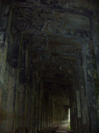
Wellington and the original Stevens Pass Tunnel are reputed to be haunted. Joni Schinske, Museum Director for the Edmonds-South Snohomish County Historical Society, said of Wellington. "I went to Wellington with no preconceptions. It was my second trip there and my interest was strictly historical. I could feel a presence that made me uneasy. Then I heard a steam whistle. Even if there was a train on the lower railroad, a steam whistle doesn't sound like a diesel. I haven't been back to Wellington since."6 Joni is not the first to believe that Wellington and the Cascade Tunnel are haunted. Some claim to have seen or photographed orbs of light in the old Cascade Tunnel and in the concrete snowshed that now covers the location of the Wellington Avalanche, west of the old townsite.
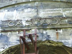
I had visited the tunnel portals at Wellington, or the Cascade Station side of the Cascade Tunnel about 10 times before this trip. Melissa and I walked along the Upper Iron Goat Trail as far as the west end of the concrete snowshed that was built in 1911 to protect the railroad from a possible repeat of the 1910 avalanche. Melissa had not been to Wellington before and was interested in what I knew, and was intently reading the information at the interpretive stations. Melissa had read Gary Krist's book, The White Cascade, as had I. We had it in the car, and a couple of old photos that I had printed from Bob Kelly's web site. We used the maps and photos as references for our tour of old Wellington, in addition to the interpretive stations. No buildings remain; those were all burned down in 1929, as were the buildings in Cascade Station, Berne (east of Cascade Station), and probably Embro and Corea as well. Alpine may have been burned at about the same time, but for different reasons and it wasn't burned by the railroad. At Wellington the concrete abutments of the old Haskell Creek bridge remain, and the concrete foundations of the water tower, the coaling tower, and the foundation of the repair shed for the rotary snowplows and electric engines. The repair shed was a little bigger than most sheds; it was about 300 feet long and had some resemblance to a Grease Monkey in that the mechanics could get under the rotaries and snowplows to service the units from underneath.
Melissa was disappointed that we couldn't approach the west
portal of the old Cascade Tunnel. When we had walked around Wellington for an
hour or so, I drove us east to the Cascade Station portal. It is still
 accessible, and probably will remain accessible for a few more years. The old
tunnel is lower on the Wellington (west) end than it is on the Cascade Station
(east) end. Water in the tunnel runs downhill to Wellington from Cascade
Station. There is no danger of a sudden release of water at the Cascade Station
site. The Cascade Station side of the tunnel is also probably in somewhat better
shape than the Wellington end. Only 3 miles apart, the Cascade Station portal is
in the "rain shadow" of the Cascade Mountains, and receives noticeably less snow
and rain than the Wellington end. The tunnel is
still dangerous at the east portal, just less dangerous than the west end. I am
just as unwilling to walk very far into the east portal as I was into the west.
It is just too dangerous.
accessible, and probably will remain accessible for a few more years. The old
tunnel is lower on the Wellington (west) end than it is on the Cascade Station
(east) end. Water in the tunnel runs downhill to Wellington from Cascade
Station. There is no danger of a sudden release of water at the Cascade Station
site. The Cascade Station side of the tunnel is also probably in somewhat better
shape than the Wellington end. Only 3 miles apart, the Cascade Station portal is
in the "rain shadow" of the Cascade Mountains, and receives noticeably less snow
and rain than the Wellington end. The tunnel is
still dangerous at the east portal, just less dangerous than the west end. I am
just as unwilling to walk very far into the east portal as I was into the west.
It is just too dangerous.
Nevertheless we did venture a few feet into the east portal. It sounded like someone, or a number of people, was working inside the tunnel. There were hammering noises, or construction noises, but we didn't see anyone or any worklights. There should have been no one there, and there certainly should not have been any work going on. I had been in the two portals a combined total of about 10 times; I had never heard anything. The tunnel was usually quiet except for water, dripping from the ceiling and running in the ditches, and the voices of visitors. This was the first time that I was ever uncomfortable in the tunnel. I wanted to get away. Melissa, however, was enjoying herself immensely, snapping photographs of the tunnel and enjoying the moment at a place she had wanted to see for a long time. Eventually we walked back to my car and drove down the mountain to a pleasant early dinner at the Cascadia in Skykomish. After dinner Melissa humored me by allowing me to take a few of the backroads home instead of the highway. In Startup, we found that the road that is now called the Sultan-Startup Road was certainly part of the old Stevens Pass Scenic Highway. On the Startup side of the Wallace River the road turns sharply back on itself to go up to Highway 2. We could see where a bridge had once spanned the Wallace River at that point. On the Sultan side of the river we could see where the new road crosses the route of the old road as the old road more closely followed the line of the river than the highway does now.
The surprise about our trip to Wellington and Cascade Station
came 2 weeks later when Melissa downloaded the photos onto her computer and
looked at them. Visible in one of the photos is a famous Cascade Tunnel "orb".
These have appeared in photos taken in the old Cascade Tunnel and in the
concrete snowshed at Wellington. I had never personally seen one, and I
certainly hadn't seen any that day as we stood in the east portal. But there in
the photo is an "orb". A raindrop maybe? Except it wasn't raining; it was gray
day and it wasn't a reflection of a sunbeam either. A drip from the ceiling of
the tunnel? This is more plausible, and we wouldn't necessarily have heard it
with the pounding noises in the tunnel. Ah, those noises. What were they? There
were no other cars in the vicinity that day. Someone could have walked from a
cabin nearby, but we didn't see anyone. The tunnel isn't exactly a gathering
place, except for eccentrics, like me. What was the 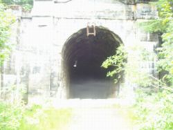 noise and did it have
something to do with the "orb"? Some have metaphysical answers to the "orbs" -
ghosts and such. And maybe they are right - I was uncomfortable that day.
But I like hard, tangible, scientific, answers, and ghosts are definitely not
hard, tangible, scientific, answers. The mystery deepened a few days later when
Melissa enlarged the portion of the photo containing the "orb". In the
enlargement the "orb" seems to take on facial features - demonic, maybe, or
otherworldly. One viewer thought the image looked like a miner's hat with two lights, perhaps the ghost of one of the men who built the tunnel. All these thoughts are definitely beyond the type of scientific answer I would like to
see.
noise and did it have
something to do with the "orb"? Some have metaphysical answers to the "orbs" -
ghosts and such. And maybe they are right - I was uncomfortable that day.
But I like hard, tangible, scientific, answers, and ghosts are definitely not
hard, tangible, scientific, answers. The mystery deepened a few days later when
Melissa enlarged the portion of the photo containing the "orb". In the
enlargement the "orb" seems to take on facial features - demonic, maybe, or
otherworldly. One viewer thought the image looked like a miner's hat with two lights, perhaps the ghost of one of the men who built the tunnel. All these thoughts are definitely beyond the type of scientific answer I would like to
see.  But it is also an answer that will need to wait. I wanted to get back to
the search for Alpine. The mysterious construction noises that Melissa and I heard in the tunnel when there was no construction going on; the whistle of a steam engine that Joni had heard when there was no steam engine; the Cascade Tunnel orbs of light when there was no source of light. These are mysteries for someone to solve, but it probably won't be me. Alpine is enough of a mystery.
But it is also an answer that will need to wait. I wanted to get back to
the search for Alpine. The mysterious construction noises that Melissa and I heard in the tunnel when there was no construction going on; the whistle of a steam engine that Joni had heard when there was no steam engine; the Cascade Tunnel orbs of light when there was no source of light. These are mysteries for someone to solve, but it probably won't be me. Alpine is enough of a mystery.
We went back to Cascade Station 2 years later on August 17, 2010. Melissa and I were joined by Brian Harris, Levi Logstrom, Jenna Perry-Zapara, Matt Cawby, and Donna Beaudry. Melissa and Matt got some lovely "orb" photos. All of the photo orbs taken that day can be identified as lens reflected light. The prismatic effect is beautiful, but it is nothing like the photos Melissa took in 2008. Prismatic photo orbs can be duplicated in almost any dark, damp environment. Whatever it is that appeared in Melissa's photos in 2008 wasn't replicated. The photo to the left shows 3 orbs. Click on it to see an enlargement. Then compare it to the enlargement of the photo on the right taken at the same location 2 years earlier.
Alpine shares a bit of history with Cascade Station and Wellington and their ghosts. When the avalanche devastated Wellington on March 1, 1910 the nearest working telegraph was at Nippon depot. James H. O'Neill walked through 3 miles of 3-foot deep snow from Scenic to reach Nippon. The message that alerted the Great Northern Railway, and the world, of the deadliest avalanche in United States history, and one of the worst railroad disasters of all time, was sent from Nippon depot. 4 years later the Nippon depot was renamed Alpine to correspond with the post office name of the town that had grown up around the saw mill.
Great Northern Day in Skykomish
Each year in September the Skykomish Historical Society and the Great Northern Railway Historical Society sponsor "Great Northern Day" on a Saturday. Veterans of the Great Northern Railway, railfans, and anybody who has an interest gather in the small museum in Skykomish, Washington to talk about the history of the railroad. The Great Northern Railway ceased to exist in 1970, nearly 40 years ago, and the number of railroad veterans is smaller every year. Some who come are model railroaders in search of information that will make their model railroad layout accurate in every detail. Some are people who like to take pictures of trains, and like to see old pictures of old trains. Some, like me, are interested in the history - history of the railroad and history of the towns and people who once lived there. We gather in Skykomish; in 2008 the gathering was on September 13. Skykomish was once an important stop on the Great Northern Railway. Electric engines were connected to trains in Skykomish to pull the trains through the "new" Cascade Tunnel. A power plant to electrify the railroad by converting the AC from the power grid to DC for the electric motors once stood in Skykomish. It is long gone, and the roundhouse is long gone, and almost everything else is long gone. More than 2000 people once lived in Skykomish - fewer than 300 live there now. But a renaissance may be at hand.
Skykomish is in the process of moving almost the entire town. Actually the downtown is being moved out of its space and moved back again. During the time that the Great Northern Railway used Skykomish as its 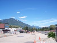 west Cascade headquarter, there was oil stored in tanks. Those tanks leaked
 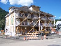 into the soil and, ultimately, into the south fork of the Skykomish River. In 2006 a project began to remove the oil and clean the soil. To accomplish this end the buildings in the town must be moved from the locations where they have stood for 100 years or more. After the contamination in the soil is removed the buildings are placed back in the original positions on new foundations. The McEvoy house, which stands next to the Cascadia, looks to be in the best condition it has seen in 100 years. The project has been a strain on Skykomish and Skykomish businesses. If Skykomish survives the move, the town may be in the best condition that it has ever been. A new "Town Center" is planned for Skykomish. The "Town Center" will include vintage Great Northern Railway engines and cars. The old Great Northern depot will move back near its original location on the south side of the railroad tracks.
Sky lives on into a 2nd century. The other towns of the upper Sky Valley - Heybrook, Halford, Baring, Grotto, Miller River (Berlin), Tye (Wellington), Corea, Scenic (Madison), Embro (Alvin), and Alpine are gone or much reduced in size. Index, at the confluence of the North and South Forks of the Skykomish River is also reviving some. Index has purchased Heybrook Ridge to the south and the granite "Climbing Wall" on the north, to preserve the character and appearance of the town. The combined effort to buy those assets cost nearly 2 million dollars, and will continue to need financial donations for some years to come to properly maintain the assets. Index has at least one other worthy project that isn't yet complete. The Bush House was a well-known hotel and restaurant from 1898 until the turn of the millennium. Reputedly, 3 United States Presidents have stayed there. The record isn't entirely clear on the first 2, but President Truman certainly stayed there during his campaign in 1948. The Bush House is now in a state of near collapse; it will be a shame if it is not preserved, but the cost for it will certainly run more than 1 million dollars to repair. I hope that Index may find the energy to preserve this portion of its heritage. I have never stayed in the Bush House, but I and my family enjoyed several wonderful dinners there during the 1980s and 1990s.
If we go ahead with a project to preserve Alpine from further destruction by the forest and weather, it will probably cost an amount similar to what Index has spent on their projects.
But I have gotten ahead of the story. I had begun to search for Alpine in June of 2008 and in mid-September 2008 I still hadn't found it. I hoped that someone would be able to help me find Alpine. In that I was almost successful at Great Northern Day, and I had a chance to have enjoyable conversations with a number of people.
Several people suggested that I talk to Pat Casey. Pat is known as the "Foss River Hermit". He lives well up the Foss River Road, near the Foss River trestle of the Burlington Northern Sante Fe Railroad. The Foss River trestle was built by the Great Northern Railway, the predecessor of the BNSF. I called Pat Casey a few days later and met him in Skykomish the next week. With Pat I walked along the BNSF railroad tracks to the site of the Tonga Station on the old Great Northern. Pat owns the southeast corner of the old Tonga townsite, but most of it is owned by Longview Fibre. When we walked the land in September 2008 it had already been surveyed in preparation for logging. At the site of the old depot we found bricks, broken crockery, and the remains of what appeared to be at least 2 wood stoves. Whatever else may be under the growth will probably be crushed by heavy equipment logging the area. That will be a shame. But Pat had never visited Alpine in the 45 years that he had owned a place on Foss River and didn't know exactly where it might be or how to get to it. Pat did have a suggestion. In Startup, at the little white church that was now an art gallery, I would find Bill Schlicker. He owned property in the general vicinity of Alpine. If he didn't own Alpine he would probably know who did own it. Pat also mentioned his brother-in-law, Jack Christensen, who lives in Edmonds. Jack is a former Northern Pacific and BNSF engineer. He is a noted artist, usually painting railroad scenes, and as a local railroad historian he often speaks to groups about railroading. Jack is also my neighbor, only about 8 houses down 9th Avenue, but we had never met. He is a very interesting man, but he really had no information about the town of Alpine.
Several people at Great Northern Day in Skykomish also suggested that I talk to Ted Cleveland. I had met Ted 2 years before when he had been one of the speakers at Great Northern Day. Ted was born in Skykomish. He worked for the Great Northern Railway. He had been the fireman on the last electric engine that had left Skykomish to pull a train through the Cascade Tunnel on May 31, 1956. Ted had been mayor of Skykomish twice. When I called Ted he remembered Alpine. He had ridden the train through the vicinity of Alpine hundreds of times. But more than that, he remembered Alpine. He remembered seeing Alpine as a boy, when he was 5 or 6 years old, he had walked into Alpine with his father. The buildings had been empty. There was no one there but the wood and concrete evidence that this had once been something. But as to how to easily get there now he didn't have an answer. Ted did suggest, as Pat Casey had, that I talk to Bill Schlicker in Startup.
It was the last person I met at Great Northern Day, Matt Cawby, who had the most immediate interest in Alpine. Matt is a photographer from Mountlake Terrace, WA. I quickly infected Matt with the Alpine Flu and within 2 weeks he found Alpine and took photos which are at his web site. Matt is noted for photographing Boeing jets, but he also is interested in trains and the history of the Great Northern Railway. He and his dog walked into Alpine and took pictures, then matched the present day photos to archive photos at the Skykomish Museum. Unfortunately it was a few more days before Matt let me know how to find, and more importantly how to get into, Alpine. By then I had visited the little white church in Startup, talked to Bill Schlicker, gotten permission to visit Alpine, and learned the shortest way in. For Bill Schlicker did indeed own Alpine, but confirming that had been a task in itself.
Maps, Tax Records, and Research
After Great Northern day in Skykomish I had looked at the maps
in the Skykomish Museum and Bob Kelly had made a CD for me of old photos of
Alpine and included a 1922 map of Alpine from the Great Northern records. I also
had 2 topographic maps. The Green Trails map showed sections 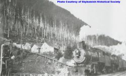 but not the
corresponding section or township number. The National Geographic map that I have includes section numbers but not the townships numbers or range. On
Monday I began to find my way through King County tax records. From the maps I was reasonably certain that Alpine was in section 26, but I wasn't certain what township or range. I used my background as a real estate broker 40 years ago to guess that Alpine might be in Township 26 North, Range 12 East, Willamette Meridian. It turned out to be a good guess. There in the King County records was Alpine. It literally stuck out like a sore thumb. On the 1922 map of Alpine the area owned by the Great Northern Railway included a long diagonal connecting segment that met the railroad at one end and led to a diamond shaped parcel, centered on Carroll Creek, at the other. This was the water supply, certainly for the water tower for steam engines, and possibly for the town of Alpine as well. On the King County tax map this parcel is still the same shape. It is now identified as former Great Northern Railway right-of-way, and it is now owned by Burlington Northern Sante Fe Railroad,
but not the
corresponding section or township number. The National Geographic map that I have includes section numbers but not the townships numbers or range. On
Monday I began to find my way through King County tax records. From the maps I was reasonably certain that Alpine was in section 26, but I wasn't certain what township or range. I used my background as a real estate broker 40 years ago to guess that Alpine might be in Township 26 North, Range 12 East, Willamette Meridian. It turned out to be a good guess. There in the King County records was Alpine. It literally stuck out like a sore thumb. On the 1922 map of Alpine the area owned by the Great Northern Railway included a long diagonal connecting segment that met the railroad at one end and led to a diamond shaped parcel, centered on Carroll Creek, at the other. This was the water supply, certainly for the water tower for steam engines, and possibly for the town of Alpine as well. On the King County tax map this parcel is still the same shape. It is now identified as former Great Northern Railway right-of-way, and it is now owned by Burlington Northern Sante Fe Railroad, 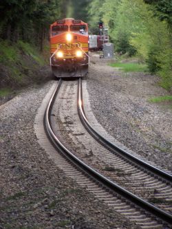 among the thousands of parcels that BNSF has acquired over the years and probably has no idea that they own it or what to do with it.
This odd-shaped parcel of land cuts almost through the middle of tax parcel 2626129021. 2626129021 and its neighboring parcel 2626129012, and the former Great Northern Railway right-of-way, tax parcel 2626129019, are clearly the Town of Alpine. And it was here that I would find what I was looking for. According to King County records, tax parcels 2626129021 and 2626129012 both belong to Wilfred Schlicker of Startup, Washington. The information from Pat Casey and Ted Cleveland was correct. Unfortunately the tax records did not include an address or phone number. No listing in the phone book or on-line either. I would need to drive to Startup, to the little white church that was now an art gallery and rock shop, to find Bill Schlicker. That Saturday Bill wasn't in Startup. He had already left for his winter home in Rodeo, New Mexico, but his sister Mary Beth was working at the gallery. I told her about my Quixotic quest and she picked up the cell phone and called Bill. "I understand you own Alpine", I opened the conversation. "Oh", was the response on the other end. "Well that's what King County tax records say", I continued. "Then I guess I do". Actually Bill knew a great deal about Alpine and its history. Unfortunately he was in New Mexico. Unfortunately the key to the gate was with him. There was a gated road that I hadn't noticed. I had probably driven by it 50 times or more. Beyond that gate was the road to Alpine. It was still possible to drive into Alpine, but we wouldn't be driving in this year. I now knew the location, I had the property owner's permission to go on his property, and a walk of about 1 mile wasn't going to be a problem, even if the walk was virtually up the steep side of Mt Sawyer.
While doing the research to find the Town of Alpine, other interesting things had popped up. Glenn Forrest researched tax records and property maps. I was looking for cemeteries and information about Carl Clemans. There didn't seem to be a cemetery in Alpine; there also didn't seem to be a cemetery in Skykomish, although what is now called the Old Cascade Highway appeared to be called Cemetery Road on one old map dating to 1930. I thought that all towns have cemeteries. My mother was from Ridge, Montana (Population 2 in 2004) and the cemetery has 73 graves. It is difficult for me to imagine that Alpine, population 300?, and Skykomish, population 1000+?, didn't have cemeteries. Did they really transport bodies down the railroad to Sultan or Snohomish? Carl Clemans maintained a home in Snohomish before and after he owned Alpine. It seems natural that his son, Carl Lane Clemans, Jr. was buried in the Grand Army of the Republic Cemetery in Snohomish. Carl Jr died in 1908, when he was less than a year old, and his father was just getting the lumber company started in Alpine. But what about other individuals and other families - how did they handle the inevitable deaths. I don't yet know, but there is until now no evidence of a cemetery in Alpine or Skykomish. We know there were deaths because the names of those who died in Alpine are mentioned in the annual report given the attendees at the annual banquet in Alpine. Maybe it will be possible to trace the names in the annual report to places of burial, and then we will have an answer.
I haven't found a cemetery in Alpine, but cemeteries did turn up in unexpected places. I found a U. S. government record that listed a pioneer cemetery on 212th Street SW, just east of 84th Avenue W in Edmonds. The area is called Five Corners because 84th Avenue, and 212th Street meet the end of Bowdoin Way at an intersection that is a 5-way stop. My business is on the SW corner of 212th and 84th, with an actual address on Bowdoin Way. The cemetery must be within shouting distance of my store. I had never heard of a cemetery at Five Corners. There are 2 churches nearby and I assumed that the record must be talking about a church graveyard. I couldn't find (and I never have found) the U. S. Government record again, but I did find someone who knew about the existence of the graveyard. Steve Beck is a former president of the Edmonds-South Snohomish County Historical Society and the former owner of Beck's Funeral Home in Edmonds, Washington. Steve knew where the graveyard was and had a Polaroid photo from 1986 that showed 2 of the tombstones. The last burial appears to have been in 1953. It appears that construction may have occurred very near or on top of the old cemetery. While asking questions about the Five Corners graveyard, 2 different people mentioned an old graveyard that existed at the top of Dayton Street in Edmonds. Whether this graveyard is inside Yost Park or outside the park boundaries, under houses, is not known; there is less evidence for the existence of this graveyard, but it may be there.
Constructing on top of a graveyard seems unconscionable, but it does happen. It Seattle there is the notorious case of the Comet Lodge Cemetery. I remember my parents pointing out to me and my younger sister the pioneer cemetery on Graham Street in Seattle. We didn't know much about it except that it was not maintained, but you could see tombstones as you drove by. This may have been as early as 1953. According to http://www.worldperc.com/comet/faqs.shtml the last burial in the Comet Lodge Cemetery was of a 3-year old boy in 1936. Property disputes and disputed ownership claims, and careless supervision by the City of Seattle led to construction over as much as half the cemetery. It appears that the developer bulldozed tombstones, graves, and remains in the graves, and hauled everything off to the dump. Whether this also happened in my home town of Edmonds awaits further research. I was looking for a cemetery in Alpine, and haven't yet found one, and haven't found one in Skykomish either, which seems very strange, considering that a tiny place like Chiwaukum has a cemetery.
What I had found was a route into the town of Alpine, and I had permission to use it.
First Visit To Alpine
On October 9, 2008 the day arrived for me to visit Alpine for the first time. A few days before I had seen Matt Cawby's photos of Alpine on the new web page he had created. I already knew that we would find much more than 2 cornerstones. I was eager to finally enter Alpine and see just what we could find. Jackie Cuddy accompanied me and she was the photographer. The hike up the gravel road road from Highway 2 was very steep. I wouldn't have driven in my van even if we had a key to the gate. A 4-wheel drive is the only vehicle for this road. It was a cold day and the snow level was at about 2000 feet. The old Alpine depot had been at about 1800 feet elevation. The mill was at about the same elevation. The boarding house and liberty hall would be a few feet lower and the school about 40 feet higher. After walking less than 15 minutes we broke out into the clearing of the Bonneville Power Administration power line. An inspection road runs under the power line towers. The inspection road is little more than a 2 groove track where inspection vehicles drive in warm months, but it is in good condition and relatively level. The walking was easy as we turned west for about one-quarter mile. I completely missed the turn-off to Alpine although it was obvious what it was, but Jackie 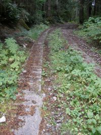 noticed it and we turned uphill again. In less than 300 feet, 2 parallel ribbons of corrugated concrete told us that we had arrived. I only knew about old driveways in Seattle built this way. The road probably dated from the 1920s when concrete was too expensive to wastefully pour an entire road. The concrete was just the width of a truck's wheels. It was corrugated for traction, and it was only long enough to make the steepest part of the road into Alpine accessible to trucks. Above and below the steepest grade the road was dirt and gravel.
Disappointment followed as we walked through abandoned vehicles that were clearly much newer than 1929. A second disappointment was that I realized I had left the map of the town in the car, and I wasn't going to go back to get it. We would have to wing it. I tried to visualize the map, but I wasn't very successful. Because we didn't have the map we walked right past the location of the mill and continued up to the BNSF railroad tracks. We did see a bridge across Carroll Creek. It looked too new to be of Alpine vintage. Months later I would learn for certain that the bridge was much newer than Alpine, but that the remains of timbers from the original wood bridge that had connected the mill and the boarding house area still lay crumbled, but not totally gone, in the cold waters of Carroll Creek under the newer bridge. I decided to climb higher to look for the water supply location along Carroll Creek. And we would be in the area of the school so we would look for that too.
At the railroad tracks we paused to listen and watch for trains. Eastbound trains are no problem. The diesels are at full load and there are usually 4 or 5 diesels pulling a train. The train is climbing a 2% grade, one of the steepest in the entire BNSF system and is traveling no more than 20 miles an hour. There is plenty of time to get out of the way. You can hear the train for at least 15 minutes before it gets to Alpine. I don't know how far the sound carries, but in Alpine the train is probably first heard at Foss River - 5 miles away. The sound may even carry all the way from Skykomish, which is 8 railroad miles away. It is the westbound trains that are just plain dangerous. Westbound the trains are coasting, braking against the grade, trying to hold speed down for the horseshoe bend at the Foss River trestle, which has been the site of notable derailments. Westbound trains are quiet. Even at low speed a train can be on you in a hurry. The railroad track curves just east of Alpine. A westbound train will be within 400 yards when it comes into view. A train cannot stop in 400 yards. The engineer's only option is his train whistle, and it is startling if you aren't aware of the train and aren't expecting the whistle. If you visit Alpine do not linger on or near the tracks. The relics to see in Alpine are not near the tracks and you shouldn't be either. A further reminder - Alpine is private property - please respect the owner's rights and don't go there unless you have permission. 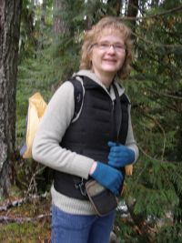
Jackie and I crossed the tracks and began to climb the north slope of what I believed to be Mt Sawyer. We were on the west side of Carroll Creek, looking to see if any pipe or culvert from the water system was evident. Great Northern Railway diverted water from Carroll Creek above Alpine to the water tower which stood east of the Alpine depot on the south side of the tracks. Alpine only existed during the days of steam and steam engines needed huge amounts of water to make steam. As we climbed beside Carroll Creek we found broken sections of cast iron pipe, and decided that we had found what we were looking for. Actually we hadn't, but it was several months before we knew that. In general we were just wrong about everything we did in the first hour, and it was almost totally because of the initial mistake I had made by not bringing the map of Alpine. But we had fun. We could see immediately that there was more to Alpine than a pair of cornerstones.
We found cast iron pipe, and iron that looked like it had been from a roof. We found washtubs, and pails, and bottles with thick glass. Jackie photographed everything we saw and we put it back where we found it. I took only one picture and that was of Jackie. We gradually scrambled west along the slope, thinking that we would bump into the school. We weren't high enough on the side of the mountain. We did find what we first thought was the school, but either it was not the school or the school was smaller than we expected from the Alpine town map. Later we learned that it was not the school, but probably just a house. Gradually we descended the hill to the vicinity of the Alpine depot. At the location of the Alpine depot we found old bricks, some whole, but more often broken, and some associated not with the depot, but with more recent track welding. I paced off the distance to the bridge and it was exactly right. We had found the Alpine depot. In truth we shouldn't have been there; the location of the depot is on BNSF property and I didn't have their permission to be there. 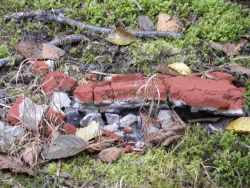 About that time a train came drifting down the grade toward Foss River. The engineer whistled several times because we were too close to the track. When he realized that Jackie had situated herself to take a picture of the train the whistling stopped. We moved east along the railroad. Jackie found moss covered concrete. It was the foundation of the old water tower. I had walked right over it without recognizing it.
The weather was cold. Snow was only about 400 feet above us. We were tired after scrambling in the underbrush for 2 hours. Fortunately the walk back to my car was downhill; we wouldn't have made it uphill. At the bottom we walked over to Alpine Falls on the Tye River. Once, a couple of generations ago, Alpine Falls  was a tourist destination. There was once a store at Alpine Falls. Now almost no one even knows the falls are there. There is enough parking for about 10 cars, but there are seldom more than one or two parked there. Alpine Falls is a beautiful sight. I don't know whether Alpine Falls was named first, or Alpine Creek - a mile west of Alpine Falls, or the town of Alpine, or the Alpine Lakes Region. The name seems suitable to all, but which was first? I don't know. I do know that the post office was named Alpine before the railroad depot. For a time the post office was Alpine and the depot was Nippon, but I don't know how the post office came to be Alpine in the first place.
We decided not to walk to the base of Alpine Falls and climb up again. That was a good decision. I did that walk a week later when I hadn't gone into the town of Alpine, and the amount of energy it took to climb back up from the base of Alpine Falls would probably have killed me after hiking around the town of Alpine for 2 hours. If I was going to spend much time in Alpine I would need to get into better shape.
From the photos that Matt Cawby had posted on his web site, we knew that there was a lot of the town of Alpine that we hadn't seen. After examining the map that night I was certain that Matt, his dog Keesha, Jackie, and I had only wandered over about 20% of Alpine. There would be more remains of buildings and other relics to find when the snow was off again. That might be 6 months or more. It snows in Alpine; it snows a lot in Alpine, which is why everything seems to be named Alpine in the area. I didn't own a 4-wheel drive or a snowmobile. I wouldn't be going back to Alpine for many months, and another winter would do its work to destroy the remains of the town. We left whatever ghosts might be in that little town that I had sought for 3 months, and headed back down the Tye/Sky valley to Skykomish. As is now my custom when in Alpine or Wellington, we stopped at the Cascadia Inn in Skykomish to enjoy a Cadia burger before driving back to Edmonds. I think Jackie ordered something smaller, but I was hungry and tired and a Cadia burger sounded just about right. It wasn't a time to worry about cholesterol or calories.
I had visited the little ghost town of Alpine after 3 months of looking for it. I had already visited Tonga and Skykomish. The next Great Northern Railway Station would be Miller River/Berlin about 2 miles west of Skykomish. I had visited Alpine and I could be finished with it as I was finished with a dozen other stations. Not that I wouldn't ever go back; I had been to Wellington at least 6 or 7 times, and I had been to Cascade Station at least 3 times. I could go back, but I could also go on, except that Alpine was tugging on my spirit. There was unfinished work for me in Alpine and I found I really couldn't go on. It was because of Carl Lane Clemans. Clemans maintained his home on Avenue C in Snohomish before, during, and after Alpine was occupied, but he is inseparable from Alpine and Alpine is inseparable from him.
Both Clemans and Alpine have been almost lost to history. In a few places only the memory of Clemans remains. In Snohomish, Washington the Clemans house at 315 Avenue C is recognized as one of the historic houses of Snohomish. Sigma Nu Fraternity recognizes Clemans in its Hall of Honor; Clemans was inducted in the inaugural class of inductees to the Sigma Nu Hall of Honor in 1948. Most notably Clemans is remembered in the Emma Lord series of mysteries written by Mary Daheim. Most of the books in the Emma Lord series take place in Alpine, home of the Alpine Advocate newspaper,and Carl Clemans is mentioned in several of the books. And last, if you dig deeply enough in the sports histories of Stanford and the University of Washington you will find the name of Carl Lane Clemans and a few very brief memories of his football career.
The Remarkable Carl Lane Clemans
I couldn't go back to the town of Alpine for a while, but I could continue to research the town and the man who is so intertwined with the history of the town of Alpine, Carl Lane Clemans. The first things that I read about Carl Clemans made him appear to be a true saint. Those depictions may be exaggerated, but I have discovered that Carl Lane Clemans was a unique and remarkable individual, with flaws like the rest of us, but with outstanding characteristics that made him stand apart.
Carl Lane Clemans was born in Manchester, Iowa. 7 Mr Clemans attended Cornell College in Mount Vernon, Iowa. Clemans maintained an attachment to Cornell College for all of his life. "Alpine made famous" 8 when on July 18, 1925 a number of alumni of Cornell College celebrated together in Alpine, and picnicked at  Star Lake. Clemans' daughter, Kate, and his wife, Harriett, attended Cornell College in the 1920s. According to Sigma Nu fraternity, Clemans founded the Sigma Nu chapter (Chi) at Cornell College, the first of several he would found. According to Cornell College records, Clemans earned a B Ph at Cornell in 1888.
From Cornell College Clemans traveled west to Stanford in 1891, when that school opened. At Stanford Clemans also left his mark on history, at the university and on the football field. Clemans participated in the first inter-collegiate football game ever played on the West Coast of the United States. Clemans scored the winning touchdown as Stanford upset favored Cal, which had fielded a football team for ten years and was physically heavier. In November 1954, Sports Illustrated wrote about March 19, 1892, the eventful day when Stanford and Cal met on the football field for the first time in the very first "Big Game" of the 120-year rivalry. By all means read the marvelous Sports Illustrated article. Unfortunately I don't know who wrote the SI article, but, if you don't pause to read it, the essence of the story follows. Clemans role in the game is variously reported, but it appears that he was the star. The winning cheer was reputedly,"Then shout the grand old Stanford yell, we've sent her through the goal! Berkeley's line looked solid, but Clemans found the hole." 9 The team manager for Stanford was apparently quite persuasive. He talked a San Francisco sporting store owner into providing the new Stanford team with uniforms although there was no money to pay for the uniforms unless enough tickets were sold. The Stanford and Cal managers managed to rent Haight Street Grounds baseball park on the same terms. The owner would be paid when the fans paid to see the game. Ditto for the company that printed the tickets. On the subject of tickets, 5000 were printed, which suggests that the team managers were wildly optimistic or incredibly shrewd in measuring fan interest. My research indicates that a crowd of 2000 for a football game in 1892 was a huge crowd. The cost of the ticket to the first "Big Game" was 2 dollars, a day's wage. But nearly 10,000 bought tickets and saw Stanford upset Cal. The persuasive Stanford team manager was a fella named Herbert Hoover, Stanford Class 1895.
According to Ginny McCormick, who wrote an article about the original "Big Game" in the Stanford Magazine in 1997 on the occasion of the 100th renewal of the "Big Game", the team leader for Stanford in 1892 was John Whittemore, a senior who had transferred to Stanford from Washington University in St Louis and had played 2 years of football there. He was the only experienced player on the Stanford team. Whittemore led the team with good judgment and a good plan. Whittemore realized that the football wasn't properly inflated (it actually had the wrong bladder - kids these days don't know about bladders in footballs). Based on that knowledge Whittemore elected to kick off expecting that Cal would fumble. It took a couple of plays, but he was right. Stanford took the ball and ran what was probably the first reverse in football history. While Clemans and the quarterback blocked for Whittemore, he handed off to the other halfback who took the ball in for a touchdown, the first of 3 that Stanford would score.
The San Francisco Chronicle ran an article about the Big Game in its March 19, 1892 edition. In 2004, the Chronicle reprinted the article in 2 parts that ran on November 14 and November 21. The Chronicle article is longer than the other articles about the game and mention Clemans more often. The Chronicle article credits Clemans with playing fierce defense as well.
"During the first ten minutes of the game the advantage was immaterial. Presently the ball had been forced down nearly to the Berkeley's 10-yard line (apparently in 1892 they thought of the goal lines exactly opposite of how we do now) and the blue and goldites (California's colors were blue and gold) were getting ready for a grand cheer.
All at once a sturdy Stanfordite was seen to break out of the bunch with the ball in his arms and to be making his way around the end of the line. The air was full of red banners (Stanford's color) up on the bleaching boards and an ominous hush pervaded the Berkeley cohorts.
The man with the ball was Clemans, Stanford's sturdy left half-back. His friends yelled his name lustily and cheered until no other sound could be heard, but there were half a dozen Berkeleyites hanging around Clemans' neck by this time, and he was finally pulled off his feet, but not until he carried the ball well over the 10-yard line on his own side of the field. 10
The Chronicle article goes on to say that Clemans soon after scored a touchdown and then scored again. Stanford won by a touchdown, and Carl Clemans had scored 2 and become the first football hero in Stanford University history. .
Clemans football career wasn't over. In 1897 he was the football coach at the University of Washington. A photo of Clemans with his 1897 team is in the UW archives on line. In 1902, after personal tragedy had sent Clemans back to California, he became the Stanford football coach. Clemans had not been very successful as the coach at the University of Washington. At Stanford he met with success. His His winning percentage of .857 remains the 3rd best record for all Stanford football coaches. Apparently he didn't beat Cal in the "Big Game" of 1902, the only game Stanford lost in 1902, and by 1903 Stanford had a new coach and Carl Clemans was back in Washington, at his home in Snohomish.
Carl Clemans place in history at Stanford isn't limited to the football field. Clemans was an early editor of the Stanford student newspaper 11; he would later publish a newspaper in Snohomish, Washington. Clemans is credited with starting the student bookstore at Stanford. "Clemans was the first president of the Leland Stanford Junior University Cooperative Association - the original University bookstore" - and George Crothers, a Sigma Nu fraternity brother, was on the co-op's Board of Directors. Clemans founded the the Beta Chi chapter of Sigma Nu at Stanford, one of the early fraternities at Stanford, and one of several Sigma Nu chapters that Clemans would found. According to an article writeen by Clemans himself in 1919, the idea to form a Sigma Nu fraternity chapter at Stanford actually began in Hiawatha, Kansas as he was traveling to Palo Alto from Iowa. In Kansas Clemans visited Grant W. Harrington who suggested that Clemans should start a chapter at Stanford. Clemans had begun recruiting, while on the train, before he ever reached California. Sigma Nu was the first to actually build a fraternity house at Stanford. A marvelous discovery was made in March 2012 when Lee Altenberg discovered that the original Sigma Nu house (remodeled and enlarged several times) still exists at the corner of Alvorado Row and Campus Way at Stanford University. 12 It is the home of Chi Theta Chi student cooperative housing, which seems so appropriate since Clemans was the founder of the first cooperative at Stanford. Clemans is recognized in the Sigma Nu Hall of Honor; he was inducted in the initial class in 1948. The lease for the Beta Chi house of Sigma Nu fraternity that Clemans and Crothers negotiated in 1892 would, by a set of fortuitous circumstances and coincidences, ten years later, help to save Stanford University from possible legal and financial collapse. 13 Clemans did not participate in that campaign that culminated in 1902 because of personal tragedy that had stunned the Clemans family, but the fraternity brothers he had organized took the lead in passing amendments to the Constitution of the State of California, and supplemental laws, which enabled Stanford University to survive, and Mrs Stanford was able to stop selling her jewels to finance the school.
Carl Clemans met his first wife, Alberta (Merritt) at Stanford. Stanford was unusual in that it was co-ed from the day of its founding. Stanford was different in many ways. At the school's opening exercises in 1891, Governor Stanford said, "We have also provided that the benefits resulting from co-operation shall be freely taught. ... Co-operative societies bring forth the best capacities, the best influences of the individual for the benefit of the whole, while the good influences of the many aid the individual." 14 Reading some of the annual reports of the Nippon and Alpine Lumber Companies, it appears that Carl Clemans may have taken the words of Leland Stanford to heart, and this may, in part, along with his basic nature, account for the respect Clemans received from those who worked for him in Alpine, and may, in addition, account for some of the fond memories that were lacking in most company towns. Clemans did not sructure his business as a co-operative; it was a traditional corporation in structure. But in the nature of the the Alpine Lumber Company and in Alpine, Washington itself there were traces of the germ of co-operation. In the 1920 annual report that was included with the menu and program for the Thanksgiving banquet, Clemans wrote happily of the employees who put their paychecks into the bank and had bank accounts approaching 5 figures. 15 In that same booklet Clemans mentions the success of 11 former Alpiners who saved money in Alpine and bought farms and mills and homes of their own. This isn't the message of a traditional company town; it was a message that made Alpine nearly unique in the history of company towns. How much of this goes back to the message of Leland Stanford? How much was already in Carl Clemans character?
Carl earned his M A at Stanford in 1893. Alberta graduated from Stanford in 1895 and in 1896 the couple were married. They made their home in Snohomish, Washington. The Clemans house still stands as one of the historic homes of Snohomish at 315 Avenue C in Snohomish, Washington. At that time the town of Snohomish was the county seat for Snohomish County, and Carl was the editor of the Snohomish County Tribune. The couple had two sons, the 2nd born in early 1899. In late 1899 tragedy struck. In October, Alberta was suffering from a severe cold. Her condition worsened, was diagnosed as typhoid fever, and, at the age of 28, she died. Her mother had arrived to help care for her on the Monday before she died. A funeral service was held in Snohomish, and then all traveled to Woodland, California for the interment. Shortly after both Clemans boys also died, apparently of scarlet fever. Woodland is northwest of Sacramento. Carl Clemans may have stayed in California for some time. 2 years later he began his year as football coach at Stanford. Perhaps that year as football coach at Stanford was the boost Clemans needed to climb from a personal abyss. Not long after Clemans reappeared in Snohomish. At about this time Carl Clemans married Harriett Smith. They lived in the same house on Avenue C in Snohomish and had 4 children, 3 daughters and a son.
"The Nippon Lumber Company was organized under the laws of the State of Washington on June 16, 1907 by George W. Fairchild, W.O. Clemans and C.L. Clemans. In 1909, nothing having been done in the way of building, C.L. Clemans and Hugh Clemans of Manchester, Iowa, bought out the others interests and started building a mill which was completed in April, 1910. The plant made an average daily cut of about 30,000 board feet. On June 3, 1913, the first plant was totally destroyed by fire. It was rebuilt in record time, sawing commencing thirty-three days after the fire and thirty days after the work of rebuilding started. The following year, the slashings left by the Company's logging operations caught fire on the 14th day of July. This fire swept up the valley and threatened to again destroy the mill. Heroic work on the part of the crew saved the mill and the major portion of the logging equipment, but the bridges on the logging railway were destroyed and a heavy loss incurred. Since that time the Company burns its slashings as closely as possible behind its logging operations. On July 18, 1917, the plant was again burned to the ground. This time material was very hard to get and construction was a very difficult matter, but on September 21, cutting again commenced with the new mill. This last mill is considerably better than its predecessors and is equipped with an automatic sprinkler system, which greatly reduces insurance cost and fire risk." 16
In 1914 the railroad depot was renamed Alpine, following a request at the end of 1913 by C.L.Clemans (Carl) as postmaster, and C.L. Clemans as president of the Nippon Lumber Company. Letters went back and forth from one Great Northern Railway manager to others. 17 In February the depot was renamed, but the depot at Alvin was also renamed as Embro because of a fear that rail orders might be confused by the names of Alvin and Alpine so close together, only 8 railroad miles apart. In a direct line Nippon/Alpine and Alvin/Embro were only 2 miles apart, but the railroad completed and exaggerated "S" curve across the valley to gain the necessary elevation to reach the 3000 foot level of the Cascade Tunnel at Wellington. I haven't found the reason for the choice of Embro as the new name for Alvin in the Great Northern Railway records. The Nippon Lumber Company was renamed Alpine Lumber Company in 1920, and for the last 10 years of its existence everything was named Alpine. I also haven't found the reason for the post office name Alpine except Carl Clemans' observation that the name was appropriate for the setting. At some time the creek that is one mile to the west became Alpine Creek, and the magnificent waterfall on the Tye River below the town became Alpine Falls.
Winter
For the second year in a row Winter came early and hard in the Tye/Sky Valley in 2008. The road to the town of Alpine was early covered in more than a foot of snow in November. By the first of the year the depth of snow was closer to four feet. Then the snow stopped and it appeared that we might have an early thaw. Bad for the ski resorts, but good for me. The snow gradually disappeared and by early February there was less than a foot of snow on the ground at the base of the road into Alpine. The snow was melting so quickly that it seemed the road would be clear by mid-February. But nature had a nasty surprise for me. Before mid-February it again began to snow and snow and snow. Before the end of February the depth of snow at the base of the road to Alpine at its junction with Highway 2 was again above four feet. Good for the ski resorts and bad for me. It would be a long, hard winter after all. And it continued to snow into April.
There were several weeks that I couldn't drive as far east as Skykomish, and Alpine is 6 miles east of Skykomish. I think I have more patience than most, but after 6 months my patience was wearing very thin. I wanted to see Alpine again. I wanted to look for the school. By now I had spent enough time scouring the old map that I knew for certain that we had missed the school completely. I wanted to find the boarding house and liberty hall. We had been near those, but hadn't looked for them. I wanted to see the mill that I had walked by in October. I studied the map and planned how to attack the town. It would depend on how many people we had, and how many teams we could split into. Even if I had 10 teams of 3 people, we couldn't cover the entire 80 acres of the town in a day. If we had that many people we could cover about half the town reasonably well in a day. If we could get in soon after the snow melted, the ground cover would be low and we could see what had been hidden.
The winter went on and some who had been enthusiastic in October had lost the enthusiasm by April. It had been a long, cold, hard winter in many ways. The economy was the worst it had been since the Great Depression when Alpine had been abandoned nearly 80 years before. Some of the people interested in Alpine had lost their jobs. The stock market was bad and retirement portfolios were disappearing. The real estate market was 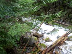 bad and some had lost all the equity in their homes. A ghost town that had seemed enchanting in its mystery had lost the enchantment in the glare of economic disaster that was literally creating new ghost towns across the country.
I did spend some time in the museum at Skykomish during the winter. There were a few pictures that I hadn't seen, but there were also annual reports from the Nippon and Alpine Lumber Companies. In these the people of Alpine came alive. Mary Daheim's mother and aunt are in one of the photographs, probably both teenagers in 1920. I stopped at the railroad museum in Gold Bar, and learned a little more about the history of the Skykomish Valley. I discovered that Reiter Road, which I had first driven in about 1974, went all the way to Index from Gold Bar. I haven't yet done the research, and I may not get around to it, but my guess is that Reiter Road is another part of the original Stevens Pass Scenic Highway. (I learned for certain in 2010 that Reiter Road is the original Stevens Pass Scenic Highway and that a gateway used to exist at the west end of Index, welcoming travelers.)
I still went to check on snow levels. I had a serious case of Alpine flu. By the first weekend in May enough snow had melted that I could park at the bottom of the road to Alpine. The gate was swinging free. Someone had smashed two of the locks on the gate during the winter. But no one was going to drive into Alpine. 30 downed trees blocked the half-mile from Highway 2 to the Bonneville Power Administration line access road. I climbed over and under and then up for air. That was almost literally true as I used up energy making my way through the trees on the steep road that uses energy quickly at all times. The BPA access road, which is just a dual track access, was clear. I followed the track to Carroll Creek and I was very pleased to find that Carroll Creek was neither bridged nor in a culvert where the BPA track crossed it. Above a small waterfall the track just disappeared into the water and came up on the other side. It obviously takes a 4-wheel with high ground clearance to cross, but the creek runs free.
I doubled back to the road to Alpine. Another 2 or 3 trees were down above the BPA access road. In the distance I saw an animal moving and couldn't identify it at 300 yards or so. Spring is bear time in Alpine and some bears have cubs. I was alone and it was time to go home. I knew that we could get into Alpine when a few others were ready. And I was ready and eager to again explore the town. Winter had lasted almost through April, but now it was time to find the rest of the town of Alpine.
Spring of Discovery in Alpine
May 14, 2009 was the date of the 2nd real visit to Alpine. I had been there 11 days before, but I had only looked to be certain of accessibility and hadn't spent any time actually exploring. There were 4 of us and I hoped to split up into 2 teams and explore separately, so long as the 2 teams stayed on the same side of the creek and reasonably close together for support. In that I was dreaming. Jackie Cuddy again accompanied me, and Jacki and Jenna Perry-Zapara. I expected to team Jackie and Jacki, and I would team with Jenna. That way if Jenna or I called to Jacki(e) they would both answer. It didn't work out that way.
On the drive up the Stevens Pass Highway we stopped at the "almost world famous" Baring store to spend a few dollars. The Baring post office is inside the building that is home to the Baring store and the  post office has been there since at least 1899. I have seen a Lee Pickett photo of Baring taken in about 1913 and the building that is the Baring post office and store is the last building visible in the background. They sell antiques and collectibles in the Baring store; in the Baring store I found commemorative plate of a visit to Skykomish on July 16, 2000 of X4449. I don't collect commemorative plates; I have a china cabinet full of plates that I want to get rid of, but I had to have that plate. X4449, which once pulled the Southern Pacific Railroad's Daylight Limited, is the only operational, streamlined, steam engine in the U.S. It is housed in Portland, and about once a year they take it out for a spin. On July 3, 2009 I (and about 200 other fools) chased X4449 up the Columbia River Gorge from Portland to Wishram, Washington, accompanied by a thoroughly disgusted BNSF police officer who had the unfortunate duty to keep railfans off the BNSF tracks. Several films of that day may be found on youtube. The rare occasions when X4449 is out for a spin is something not to be missed. Sadly, almost every operational steam engine in the country runs 10 mile outings over unvarying sets of rails on summer weekends. X4449 actually gets out to see the world. The trip in July 2009 took it all the way to Michigan.
When we left the Baring post office we traveled 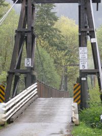 just two long blocks up Highway 2 to the east, and turned right to the old wooden suspension bridge that still carries traffic across the Skykomish River in Baring. The old bridge can only handle one car at a time and has a load limit of 10 tons, but it still carries useful traffic. We stopped a few minutes for photos, and headed east again, bypassing Skykomish, although we would return later for dinner, and on to the Foss River Road. On the Foss River Road we drove past Pat Casey's house. We didn't stop because I hadn't notified Pat that I would be in the area. If we had seen him outside we would have stopped and I would have introduced him to the J Team, but we didn't see him and continued up to the BNSF Foss River trestle. Jackie had seen the Foss River trestle before, but Jacki and Jenna had not. We stopped by
 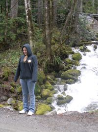 Casey Creek, which runs near Pat Casey's property and took Jenna's picture in front of it. Casey Creek is one of the baseline streams for measuring water quality. Surprisingly it is not named for Pat Casey, "The Foss River Hermit". Pat says the name of the creek predates his arrival in the area by many years, and he didn't know the name of the creek when he moved there.
The day was misty and chilly, although not as cold as the day Jackie and I had visited Alpine in October. It was cold enough that I was dressed in 5 layers including the raincoat. The women dressed similarly. The 30 downed trees that had blocked the road between Highway 2 and the BPA access road as recently as 11 days before had been cut up by somebody, and the smashed locks on the gate had been replaced. I must have been in better shape than I was in October because the walk seemed easier. The younger Js kept running ahead, but Jackie and I kept them in sight and they were noisy enough to frighten any animals that may have been in the area. On the BPA access road something metallic-looking was laying in the right-of-way. The girls asked if this was from Alpine. I didn't know what it was, but it wasn't from Alpine. Someone, with eyes much sharper than mine, realized that it was one of the spacers that hold power lines apart. It had broken and fallen most of one hundred feet to the ground. Fortunately no one was under it when it came down.
We walked past the road into Alpine so that I could show the others Carroll Creek and they could take pictures of the creek. Probably because of the wet weather, Carroll Creek was much fuller and faster than it 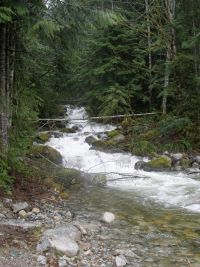 had been 11 days before. Carroll Creek bisects Alpine. The creek may be named for a Great Northern trainman who was killed in an accident in 1898. The Alpine (NIppon) mill was on the east side of the creek and the school, boarding house, and liberty hall were on the west side of the creek. At this location we were just north of Alpine and about 100 feet lower in elevation than the center of town. After photographing Carroll Creek, we backtracked to the road into Alpine and climbed the hill into the town. At this point my plan of 2 teams came all apart. What happened instead was that I became the scout and the 3 Js scoured through the undergrowth to document what we had found. As trailblazer I steered to the left to find the mill
 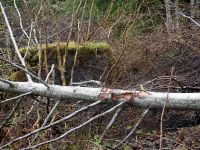 that we had missed in October, and found part of the foundation almost immediately. Jackie and I had walked within 75 feet of the mill in October and hadn't seen it at all on that occasion. Today there was less foliage and we were better prepared.
The winter hours of scouring the 1922 map of Alpine for information were paying off. Jackie and I were each carrying a copy of the map, but the weather was so wet that we left the maps in our pockets for the most part and used our memory to guide the search. I worked my way around the perimeter of the mill, and the Js took pictures. Jackie took most of the pictures, and Jacki and Jenna helped clear the brush away. Jacki and Jenna also took cell phone pictures. And part of the time Jenna helped me as I walked around about half the circumference of the mill. I didn't walk around the entire circumference of the mill because part of the mill site disappears into a gully that I think wasn't there during the heyday of Alpine. It appears that a much newer culvert under the railroad forces water through what was the east end of the mill. In about the middle of the mill, measuring from west to east, there is a road bulldozed through the foundation right up to the railroad. I used that road to climb near the railroad and find the location of the the spur track. After 80 years there is little growth in what was the spur siding, and there are no trees at all. Whatever the ties were treated with is still at work keeping the plant growth down.
I was working my way around the mill clockwise almost in the open with very little brush to contend. Jackie 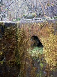 and Jacki were working their way around the mill foundation counter-clockwise through brush and trees. Jackie continued to take pictures, and was amazed at how much foundation she was finding. Our guess was that she found about 160 linear feet of foundation at the mill site,
 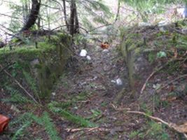 and there is certainly more under the dirt. Coming from different directions, we met at the very north end of the mill, where logs had traveled on the log way into the saw. Here we found what we had really been looking for. Some descriptions of Alpine on the internet described 2 cornerstones of the sawmill as the only surviving evidence of the town of Alpine. These weren't cornerstones, but they were what had been described as cornerstones. Actually this was where the rotary saw, the heart of any sawmill, had been located. These 2 heavy blocks of concrete and steel had been the foundation that held the rotary saw in place as it sliced through tree after tree. This was the reason for the existence of the town of Alpine. There were much newer jars and jugs in the way, from a more recent habitation in the town, or perhaps from a darker 21st century history as described in Alpine Obituary, but this was what had made the town run, and at last we had found it.
Jackie took more pictures as I described to Jenna and Jacki how the logs would have come up the log way from the north, and into the blade of the 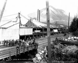 saw, to be cut into 12 by 12 timbers for the snowsheds that had dotted the path of the Great Northern Railway that was now the Iron Goat Trail. In a sense I had come full circle. I had started this search for Alpine, nearly a year before. at one of the backwalls of those long-gone snowsheds. An avalanche had blocked my path, and here was the ghost of the mill that had cut the timbers that gave the snowsheds strength to deflect the long-ago avalanches away from the path of the railroad. My search for Alpine was coming along nicely.
Despite the rain we got out the maps again and decided which direction to go next. We hadn't yet seen most of the town. The bridge across Carroll Creek from the mill to the location of the boarding house and liberty hall seemed to call us next. I tied the bridge and decided that it was too narrow 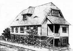 and too slick. Jackie was braver, or more foolish, and moved slowly across the bridge to the other side. The girls and I cheated and found an alternate route across the creek. Here, west of Carroll Creek, we found large stones that looked to have been piled in an orderly fashion. There was no concrete. Our guess is that the boarding house, probably the oldest building in Alpine, and the "Victory Hall", were built on stone foundations instead of concrete. There
 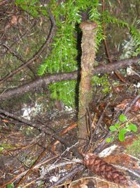 certainly seemed to be a pattern to the large stones at what should have been the locations of each building. The stones didn't seem to be random. At the site of the boarding house we found a double wash tub, very old, that may have been used for laundry. At the site of the "Victory Hall" we found heavy iron rods that would have held the timbers of the building together. Similar iron rods exist at Corea across the valley and at the location of the Alpine mill near the base of the rotary saw. In the University of Washington archives there is a Lee Pickett photograph of the performers in a play. The photo was taken in the "Victory Hall" in Alpine. We stood in the rain in the ruins of that hall. The "Victory Hall" is identified as the Liberty Hall on the railroad map we were using, but in the program and annual report for the annual banquet and dance held December 7, 1918, the hall is identified as the "Victory Hall" and there is information about the reason it was constructed for the Alpine Council for Patriotic Service. After World War I the building became the social hall for the town of Alpine. It was a 2-story building 28' by 60' with vestibules on the outside. From the photo of the building it appears that it had either a substantial attic or a full basement, depending on which is the lower and upper floor - there are definitely 3 levels in the photo. The upper was a single room for meetings, banquets and plays. The lower level had 3 rooms, one room originally for Red Cross work, but seems to have become a bar in later years, the second room was a kitchen, and the third room was a reading room and pool (billiard) room. 18
The rain hadn't let up, but we consulted our soaked maps to decide where to go next. It was my choice. There wasn't anything close by on the downhill (north) side of the railroad that I wanted to see as much as I wanted to find the school that we had missed in October. The school is directly south of the Victory Hall, about 300 feet away. The school is about 60 feet higher in elevation than the liberty hall through the underbrush, up the side of the mountain. The first 120 feet are flat, across the railroad right-of-way. Then it gets difficult. I decided that we really had to climb the direct route to the school. If we veered right or left we might miss it as we had in October. It took fifteen minutes to scramble less than 200 feet. By the time we reached the flat where we expected to find the school 3 of us had thorns in our hands. We immediately found bricks, and thought we had found the school. But it wasn't; it was too small, and, after checking the map, I realized that a small, unnamed structure was in the path between the Victory Hall and the school. Jackie took pictures there while Jenna, Jacki, and I moved 20 feet further south.
Here we found the school. The shape and size were correct. There was one thing about it that bothered me. We found 2 separate foundations, concrete, correctly placed to be the school, but with a small space between. It appeared that the school was built as 2 separate structures with a small 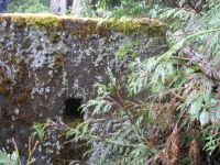 connection between. (Much later, more than a week, I found a photo of the school at the Skykomish Historical Society
 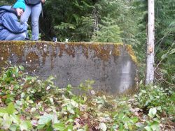 web site, taken in about 1926. I matched that with a photo of Alpine taken several years earlier that I had on a CD from the Skykomish Museum. The explanation became clear. The school had been built as a one-room school, and had been added to at some point when another room was built with a small connecting hallway between the two rooms of the school. This accounts perfectly for the construction, but on that day we didn't know it yet.) We moved around the foundation of what was the older portion of the school. Then, just a few feet south and a few feet east, was a matching foundation of the newer part of the school, the 2nd room of the 2-room schoolhouse. The newer part of the school had a concrete floor atop the concrete foundation. This building with a concrete floor is unlike any other that we have found in Alpine, except the not definitely identified building that is to the west of the school. Every other building in Alpine appears to have been constructed with wood joists and floors atop a concrete or stone foundation; Alpine was, after all, a lumber mill town. Maybe the school was built with more concrete as a safety against fire to protect the children.
 Because of the concrete floor there was little depth to the dirt. A little scraping and, voila, we began to find things that had been a part of the every day lives of the students who had studied here, 8 decades before. One of the first things that we found was a part of an electric light socket dating from the era of the Twenties. We soon found more
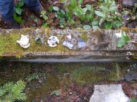 parts of that light socket or maybe parts of 2 sockets. We found several pieces of what appeared to be slate, but wasn't the color we associated with a blackboard. Later examination of these pieces revealed that it wasn't slate, but concrete. The interior wall of the 2nd room of the school house was concrete reinforced on chicken wire.
We found shards of a pitcher that may have held water or milk. We found pieces of iron that we didn't associate with any purpose. We carefully placed each of these to be photographed and then returned them to the place where we found them, to await a day when someone who knows what they are doing may do a proper dig and catalog of what is there. Jackie found what appeared to be a garbage pile in the foundation of the older part of the school. We left that alone also, not because it was "dirty" but because it may be a treasure trove for a future "dig".
Just to the west of the school was another building foundation. The 1922 map of Alpine doesn't show anything at that location so we have no idea 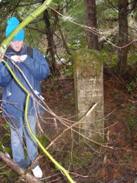 what
what  the building may have been, but I am guessing, by its location, that it may have been the "teacherage". There is a photo of a building by that name at Alpine in the Skykomish Historical Society records. 4 months later it was suggested by someone who had lived in Alpine that it might be the gymnasium. Like the school and the mill, this building has a sturdy foundation. It also has 6 concrete pillars extending to the west from the main foundation. The pillars are at different levels. The higher (south) group are taller and start higher up the hill than the low group. Each row has 3 pillars. Maybe the building had a porch, or maybe part of it was constructed above a pillar system instead of a perimeter foundation. Maybe it was a small building that was inexpensively added to. The concrete was all in good condition although it hadn't been poured as skillfully as the 2nd room of the school, and, like the 2nd room of the school, this building had a concrete floor. Also like the 2nd room of the school the inside walls were of concrete reinforced by chicken wire. We didn't measure the height of the pillars, but my guess is that each in the lower row stood about 4 feet high; in the upper row each pillar seems to be about 5 feet high. We had Jacki stand next to the lower row of pillars to give perspective comparison. Jacki is about 5' 5" and the hat added about 3 inches to her height, although she probably
 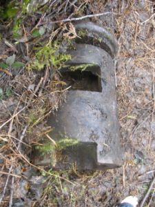 slouched just a little trying to keep warm in the damp cold.
Just below the school we found a coal stove laying on its side. We guessed that it had once been in the school and fallen down the hillside. We didn't learn all the secrets of the stove that day, but on a later trip to the school we examined the stove more closely. It certainly appeared to be a coal stove, unusual, I would think, in a lumber town. It also had fittings for pipes. About 10 feet away, in the brush, nearly covered in dirt was radiator. The school had a coal furnace and steam or hot water heat.
We were all cold and wet, and it was time to go home. One last stop at Carroll Creek for one more photo of the creek at the railroad bridge. This was the view of the creek that Alpiners would have seen every day, if they had 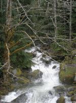 time to stop and enjoy the view at all. We walked back down the road from Alpine. When we reached the BPA right-of-way the sun decided to come out. We were too tired to climb back up the hill to Alpine, and too sore, and too prickly from the slivers and thorns. Jackie began to realize just how sore she was from crawling around in the damp to get the photos. It was time to go. The day had been very successful, and we knew we would be back. We had probably 80% of the area of Alpine waiting for us to explore. We didn't know where the landfill was, or the cemetery (if there was one), but that would be the project for another timbered and hungry, we got in the car and went to the Cascadia for the usual burgers; mine was again a Cadia Burger.
Skykomish Celebrates its 100th Birthday
On the weekend of June 5-7, 2009 the town of Skykomish celebrated its 100th birthday with a parade and a celebration. I was able to get to Sky on 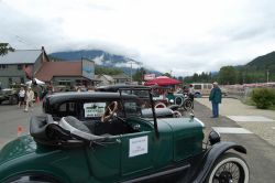 June 6 for the parade. It wasn't the Rose Parade or even Macy's Thanksgiving parade, but it was good small town fun. What it lacked in floats and pretense it made up for in energy. In Skykomish I met Toni Makinaw, her daughter, and two grandchildren. Toni is one of the owners of Alpine. Toni and Bill had given me permission to have a key to a lock on the gate to Alpine. Toni and Bill own Parallax Gallery in Startup, Washington, about 30 miles west of Alpine on the Stevens Pass Highway. Allison Abeyta from the Cascadia Inn was in the parade with her daughter; less than 3 weeks later Allison would take a memorable photograph of 3 of Alpine's closer friends as they sat at the "Burger Barn" in Alpine. For those of you who haven't read Mary Daheim's Alpine Advocate series of books the joke is lost, so I will explain. In the Alpine Advocate books the usual place for the newspaper crew to eat lunch is at the Burger Barn. There is no Burger Barn in Alpine anymore, actually there never was, so after a strenuous day in Alpine we often gather at the dining room in the Cascadia Inn in Skykomish for a Cadia Burger.
Mount Baldy, Devil's Club, and Nettles
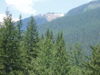
Four days later on June 10, 2009 I was back in Alpine. It had been only 27 days since my last visit. It was almost as if I had gotten lost in the mountains and driven to the wrong place. Melissa Logstrom and Martha Longbrake were my hiking partners this day and Melissa was the photographer. We stopped along the way at Alpine Falls, which was in full torrent. Martha was the adventurous one who climbed right down next to the falls. I didn't her tell the story about the body of a tourist, who got too close to the falls and fell in, found at the bottom of the falls some years ago by Pat Casey's son. Fortunately, Martha was careful with her steps and I didn't have to plunge in after her. I think I would have.
For the first time I had a key to the gate. What I didn't have was 4-wheel drive. We were able to drive more than half the distance to Alpine from Highway 2 before I was thwarted by rocks and ruts in the track. We walked first to Carroll Creek, which, like Alpine Falls, was in full torrent. Along the way Melissa  took pictures of Mt Baldy. The distinct, treeless, area near the top of Baldy showed clearly. Later in the year the same treeless area would turn green as grass grows. I don't know why trees don't grow on that part of Baldy.
Mt Baldy was the every day mountain view for the residents of Alpine. The Alpine annual report noted when the last snow was visible on Baldy and when the first snow fell on Baldy. At 5400 feet Baldy is about 3600 feet above the center of the town of Alpine. The town of Alpine was built on a steep mountainside and elevations within the town vary by as much as 400 feet.
Because of the elevation, and the nature of the Skykomish Valley, there is a short growing season. For some reason the area in the valley of the south fork of the Skykomish River gets more snow in Winter than other areas at comparable elevations. Index at 550 feet elevation seems to get more snow than Eatonville, near Mt. Rainier, gets at 800 feet elevation. Skykomish, at just under 1000 feet elevation, gets much more snow. Alpine, at 1600 to 2000 feet elevation ,gets more snow yet and it stays on the ground longer.
 The growing season in Alpine is short. The plants grow quickly to make best use of what growing season that they do have. The "little green shoots" that the Js and I had witnessed less than 4 weeks before were now 4 foot high plants. The mill that had been visible at 100 feet in May could, with difficulty, be seen from about 20 feet, and we stepped over many plants to get to the wall of the mill. In May about 160 feet of the foundation of the mill had been visible; in June we could see perhaps 20 feet of foundation. Devil's Club had burst out everywhere, and nettles and plants of other descriptions. Moving around in Alpine had been difficult in May, but in June the difficulty had increased measurably.
Melissa stayed near the railroad and took pictures. Martha and I climbed the slope south across the railroad and west of Carroll Creek. We found the foundation of a house. We also found a camp that was evidence of recent habitation by someone. Then Martha, Melissa, and I crossed to the east bank of Carroll Creek. We didn't find any houses, but we did find some carnival glass and part of a saucer that was made in Silesia. We left the carnival glass as we have left everything in Alpine, after examining and photographing. The saucer we took and Martha will try to match the pattern and markings to identify the age and source of the saucer.
I had hoped to get back to the school for closer examination, but it just wasn't possible that day. The weather was mild, but the plants were impossible, and we didn't have machetes or pruners to cut the vegetation. It was time to head to the Cascadia Inn in Skykomish for dinner. The women surprised me by treating me to dinner. I had my usual Cadia Burger.
The Man From Georgia
Two weeks later on June 25 it was time to go back to Alpine. My hiking companions were Pat Burns and Brian Harris. Pat had become an email acquaintance of mine the year before because of his web site, Alpine Pursuit, that described his trip find Alpine in 2006. We had finally met a few weeks before, and this was his first trip to Alpine. Pat is professor emeritus at Valdosta State University in Georgia. Pat is a native of Edmonds, Washington. One of the tools Pat had used to keep in touch with the Pacific Northwest, God's Country as he calls it, was the writing of Mary Daheim. Pat has read every one of Mary's 21 Alpine Advocate books. The Alpine Advocate series features Emma Lord, publisher of the Alpine Advocate weekly newspaper, and amateur detective. The series is set in the mountain town of Alpine, Washington that didn't die in the Great Depression, but has survived to the present as the County Seat of mythical Skykomish County.
In the 14th book of the series, Alpine Nemesis, published in 2001, Mary had placed an Afterword. In the Afterword, Mary gave a brief description of the real Alpine, the founder Carl Clemans, and her family in Alpine. She ends the Afterword this way, "I never saw Alpine, but it has been with me since the beginning. It lives again, at least in my imagination." 19
That quote had inspired Pat in 2006 to set out to find Alpine. He didn't find it, but his web site about that trip made a connection between us, and now  he was able to visit Alpine for the first time. Brian Harris is the husband of my office manager, Michele Harris. Brian is a 3rd-generation surveyor, and is accustomed to hiking around mountains and other inhospitable places to get an accurate survey. This was Brian's first trip to Alpine.
Brian was the walking coach as I drove around rocks and holes and was able to drive to within a few hundred yards of the mill. It was the concrete road from the twenties that I couldn't get past. My Kia Sedona is the worst traction front-wheel drive vehicle that I have ever owned, and it wouldn't pull past the first few feet of the steep, wet pavement. I gotta get a 4-wheel drive. So we walked. We carried the tools we needed for clearing brush around foundations. I led us toward the mill. Like a kid in the back seat, Pat kept asking when we would see something. I assured him the mill was there and kept moving closer. He asked how I could be sure. One way was that I could see what was left of the trail I had carved 2 weeks before. At 10 feet we couldn't see the mill, but I knew it was there. At 6 feet we couldn't see the mill. I told Pat to climb over the tree in front of the mill. He didn't believe me but he climbed over the tree. At a distance of 3 feet he could finally see the mill foundation and reached out and touched it. Again he was like a kid - this time like one who found exactly what he wanted under the Christmas tree.
Pat went to work hacking and cutting growth around the north foundation wall of the mill to bring more of it into view. In a few minutes he had slashed his hand, probably on some devil's club. We didn't have a first aid kit. I had forgotten it. Memo that for next time. We wrapped it in kleenex and napkins. Brian cut away branches from the fallen tree to ease access to the mill foundation. Later Pat and I crossed the railroad. BNSF had conveniently sent a crew to clear all vegetation on the south side of the tracks to a distance of about 40 feet. That made access to the slope of the hill much easier. We didn't find any houses and didn't find any new structures in that area, east of Carroll Creek and south of the railroad.
On the way out we tried to get photos of Baldy, but the clouds just didn't cooperate. That evening Pat and I were going to meet Mary Daheim at a book signing in Mill Creek, Washington at the University Book Store. There are a lot of bricks left laying around the townsite of Alpine. Pat asked if we couldn't take a brick to Mary. I said no. Then he said lets each take her a brick. I had not taken anything off the property except the remnant of a saucer that we going to research. But I looked at the pile of bricks and decided why not? I would tell Bill and Toni what we had done. The bricks might be firebrick, and therefore hazardous waste anyway. We took 2. Mine said CARR, and Pat's said LIVERMORE. When we reached the car we drove to Scenic to see where the survivors and bodies had come down from the avalanche in 1910 at Wellington, and then went to Wellington itself so Pat could look around there and take some pictures. Pat got pictures of trains and work crews in Scenic and photos of the Iron Goat Trail in Wellington. Finally we headed west to Skykomish and the friendly confines of the Cascadia Inn. Pat and I each had a Cadia Burger. The moment was recorded for posterity by our waitress, Allison Luker . If you ever get to Skykomish, stop at the Cascadia and, for once, ignore your doctor, don't worry about cholesterol, and live for the moment with a Cadia Burger. Don't forget to ask for a fork and a knife; you may not be able to eat the Cadia like a normal burger - it is just too big. Pat recorded his day in Alpine in photos on his web site.
I hurried back to Edmonds. I didn't have time to go home, change clothes, and shower, so I just stayed wet and dirty (probably smelly too). I picked up Jackie Cuddy in Richmond Beach (dressed elegantly casual as she often is when not climbing around Alpine or some other mountain place) and hurried to Mill Creek. Pat had more time and lived closer to Mill Creek; he went home to clean up. Jackie and I got to the book signing on time. Mary was late. When she arrived the first thing she asked was, "Are any of the Alpine people here? I mean those of you who went to Alpine today." Jackie nudged me in the ribs, and I spoke up to introduce myself. Mary and I had communicated by email for 6 months but hadn't previously met. Mary asked me to come up to the front. I gave her the brick, dirty and mossy, but freshly retrieved from Alpine. Mary's thoughts about the brick are recorded at the writer's blog of the Seattle Mystery Bookshop. Then I, unexpectedly, became the opening act when Mary asked me to tell the assembled group about the real Alpine. I did for about 5 minutes; I could have for an hour, but I cut myself short out of courtesy. Pat arrived with his brick for Mary. Although a big fan of Mary, Pat had never met her. He had cleaned up; so had his brick. "I showered with my brick.", he said. The name LIVERMORE on the brick stood out clearly. CARR and LIVERMORE are the names of the companies that made the bricks. There are other names on other bricks in Alpine, but those are the 2 bricks we chose that day. The CARR brick was made by John Carr & Sons in England. Apparently Carr went out of business 2 years before the mill opened in Alpine, so I have no idea how the braick came to be there. Shipping in 1910 would take many months and that would account for part of the time. As to the rest I suppose the brick may have lain in inventory somewhere, waiting for a buyer. The LIVERMORE brick was made by Livermore Firebrick Company, which was the first non-agricultural company in Livermore, CA. The Livermore Firebrick Company started business in 1910, the same year as the mill in Alpine. One of the first locations where firebrick from Livermore was shipped was Agnew Hardware in Everett, WA. I hope to learn someday if there was a Carl Clemans connection between Everett and the San Francisco Bay area that brought those bricks to Agnew Hardware.
After the book signing, Pat, Jackie, and I talked for a while with Mary. I had questions for Mary about the historical story between the chapters of Alpine Obituary. I recognize nearly all the names in that story; they were real residents of Alpine or the railroad. Mary says that the story is true, with a few names changed to protect the guilty. Mary was concerned about the return trip to Queen Anne from Mill Creek. She needn't have been. Mary had done book signings at the UW Bookstore in Mill Creek before, and, once in the car, her subconscious took over and ran like an autopilot. I didn't ask Pat, but I think that, despite slashing his hand in the first 5 minutes in Alpine, it had been a thoroughly successful first day in Alpine for the Man from Georgia.
July Disappointment
There were 2 visits to Alpine in July and neither was very successful. Brian Harris, Michele Harris, Jenna 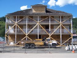 Perry-Zapara, and Jake Perry-Zapara were the crew on one or both days. We found very little that hadn't been explored before. On July 18 Brian found the location of the burner at the mill. I haven't seen a photo of the Alpine burner; I don't know if it was a traditional "wigwam" burner or not. The Skykomish Museum has a model of a lumber mill, and that model has a "wigwam burner. The 1922 map of Alpine just shows a round burner 100 feet from the mill. "Wigwam" burners were common 50 years ago. I haven't seen one in at least 40 years, but a few apparently still exist.
We didn't find anything else new. Jenna, Jake, and I managed to scramble far enough to the northwest of the Liberty Hall that Jenna was able to photograph Mt Baldy. Jake fell into Carroll Creek, but the water was low enough that he was never in danger. We also went to Wellington and Cascade Station. Michele took photos everywhere, but nothing unusual turned up on the photos.
When we got back to Skykomish, Michele took pictures of the Skykomish Hotel as it was just about ready to move for the cleanup that has been going on in Skykomish for 3 years, and which will continue for at least 2 more. The hotel was moved 4 days later. I don't yet have photos of that move.
On July 25 Brian and I were back in Alpine. Pat Burns was to join us at Alpine, and he got there, but it is a big enough place that we never saw each other. We had one goal that day - to find the line of telephone/telegraph/electric poles that runs in a northwesterly direction from Alpine to the camp along the Tye river that is generally called Alpine 2. There was a skid road from Alpine 2 up to the mill at Alpine and the poles were near it. According to Bill Schlicker, who owns the property, many of the poles are still standing. We didn't find them. That doesn't mean they aren't there. It is possible for poles to survive 80 winters. Across the Tye valley, not much more than a mile away and at a higher elevation, there are 3 telegraph poles still standing at the Corea station of the Iron Goat Trail. We did find the skid road, and we found that the BPA access road goes on for miles through some very pretty country. I hope to be able to follow that road someday; I have located the owner of the adjoining property, but we haven't yet made connections to look at his property. On the way back to the car I managed to emulate Jake by falling into Carroll Creek. I only got wet up to my knees and the day was warm enough that I quickly dried.
July ended with dry lightning strikes throughout the Sky/Tye Valley. By the first of August two small forest fires were burning within 2 miles of Alpine. On August 1, 2009 I watched helicopters dropping water on the closest fire, near Deception Falls. The helicopter made trip after trip to a lake somewhere to the southeast and then back to unload on the fire. I watched from the Iron Goat Trail trailhead below Windy Point, and then from the parking lot at Deception Falls. The Deception Falls parking lot was much closer to the action, but the Iron Goat Trailhead was a more interesting view. From the trailhead viewpoint, the sun was behind the helicopter as it dumped the water. For just a few moments the sun would prism and sparkle through the falling water. It was a beautiful sight, in contrast to the turbulent smoke climbing from the fire. But the fires were too close to Alpine for comfort. Earlier in the day I had visited the Index Arts Festival. In the early afternoon the wind had suddenly come up. Tents and kiosks were picked up and blown around. Sudden changes of weather like that are common in the Sky/Tye Valley. I wasn't going to get caught on a logging road in high wind with a forest fire nearby. In a high wind condition a fire can move through tinder dry forests at freight train speed. It was not a place I wanted to be. I would hate for a fire to burn through Alpine, but, as a practical matter, more of the town would probably be visible if a fire did go through. But those telegraph poles would probably burn up and I don't want that to happen before I can find them.
The Visit of Alpiners Back in Alpine after 80 years
 The July trips into Alpine were disappointing, but July wasn't an entirely wasted month. In July the city of Snohomish, Washington decided to set up an approved list of future street names. One of the names chosen was Clemans. That was reasonable. Carl and his brothers were well known in Snohomish. The Carl Clemans house at 315 C Street is one of the historical houses in Snohomish. I contacted the Snohomish Historical Society about the list and became acquainted with Ann Tuohy. For those of you who read the Alpine Advocate series of books by Mary Daheim, if I say that Ann Tuohy is the daughter-in-law of Doc Tuohy the elder, and wife of Doc Tuohy the younger, and that her mother's name is Vida, maybe you can make the connection. Ann connected me with William (Pete or Bill) Peterson. Bill is the only grandson of Carl and Harriett Clemans. His mother was Mary Clemans Peterson, the oldest Clemans daughter. Bill doesn't remember Alpine, but he did live there for the first 2 years of his life in 1927-1929.
About the same time Bob Crawford stopped by the Skykomish Museum. Bob had been born in Alpine the night the lights went out, September 14, 1924. There was a turbine in Carroll Creek that produced electricity for the houses and school in Alpine. The mill may have received electricity from the same source or from the boiler room at the mill. On the night that Bob was born, according to what his parents told him, a beaver dam high up Carroll Creek washed out, sending a wall of water down the creek. 20 Among the damage was the turbine that supplied the electricity. Most women would go down the valley when a baby was due, and most Alpiners were actually born in Snohomish, Sultan, or Skykomish. Bob was an exception, whether by plan or accident. Bob can claim to be a native Alpiner, a very rare designation. After the mill was closed in Alpine, Bob's family moved to Mill Town, west of Skykomish and lived there for another 2-3 years. His parents took him back to Alpine a few times. Bob remembers going into the school. There was no lock on the door. There was writing on the blackboard; there was chalk and erasers in the chalktrays; the desks were empty, waiting for the children to come back. During the depression the work stopped in Mill Town also, and Bob's family moved again. But the family did come back to the Alpine reunions. Alpiners met at Cass' Auto Park for about 12 years after the town was abandoned. Cass Auto Park was about 2 miles east of Skykomish and about 4 miles west of Alpine. The reunions were held until about 1941, the beginning of World War II and the same year the Carl Clemans died. The reunions ended and Alpine families went their separate ways, but many stayed in touch with each other.
Through Bob I met Elsie Tjerne. Elsie now lives in Monroe. Elsie is the senior Alpiner that I have found. Her family moved to Alpine when she was 6 years old in 1922. she remembers that the houses all had electricity, but that it wasn't very reliable and it wasn't very strong. The lights would often flicker, and there 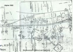 usually wasn't enough electricity for her mom to use an electric iron. I confess that it hadn't occurred to me that there would be electric irons in Alpine in the 1920s, but according to Elsie there were. Elsie has fond memories of the Clemans daughters, Mary and Kate. In the summer, when Mary and Kate were home from college, they would teach classes for the girls of Alpine, but not like ordinary schoolwork. Elsie remembers dancing classes, and swimming in the pool up Carroll Creek, above Alpine. Carroll Creek was partially dammed about 400 feet above the railroad tracks. Water was diverted to the railroad water tank for steam engines. It may also have been diverted to the houses of the town, if Elsie is correct. She says that the houses of Alpine had running water. Elsie also remembers the social hall, called the "Liberty Hall" on the 1922 map of Alpine, but called the "Victory Hall" in the 1918 menu and annual report fot the Thanksgiving banquet. 21 According to Elsie, the hall had a dance floor upstairs and a pool room and bar downstairs. Her best friend Helen's (she thinks the last name may have been Sherman) mom worked in the bar. (3 years later I learned from the 1923 menu and annual report that her name was Irene Sherman and she is listed as the "Manager Pool Room") There were dances on Friday and Saturday nights in the social hall. Mrs Adams played the piano, and Mr Adams played the banjo. Elsie's mother also played piano and her father played drums. Elsie says that the railroad was the main street of town and everybody walked on the tracks to get anywhere. Old photos of Alpine certainly confirm that. She said that when a "Silk Train" was due, the kids were told to stay off the tracks. The "Silk Trains" were the highest priority trains on the Great Northern Railway, rather like the Boeing trains today. The "Silk Train" carried silk that had been delivered from Asia and was destined for garment manufacturers on the East Coast. Speed was a necessity for the fragile raw silk bundles. Everything cleared out of the way for the "Silk Trains". When the silk was unloaded in Seattle it was moved with highest priority to the garment manufacturers in the East and in Europe; nothing would get in the way of the "Silk Trains". Other railroads also had "Silk Trains" and competed with each other for the fastest delivery. The Great Northern Railway had the shortest route to travel and the most constant grades. The Great Northern was able to get the silk from Smith Cove in Seattle to Hoboken in 3 days, a day faster than the fastest passenger train. 22
Elsie Tjerne also remembers a gymnasium next to the school in Alpine. There is no such building on the 1922 map, but there is a building that doesn't show on the map, to the west of the school that appears to have been built at the same time and using the same construction methods as the 2nd room of the 2-room school. It is one of the buildings that Jackie, Jacki, Jenna and I had explored in May 2009. Whether it is the teacher's residence as I speculated, a gymnasium as Elsie suggests, or some other building will await further exploration. The 1920 menu and annual report for the Thanksgiving banquet says that on November 22, 1920 "Work started on new high school and gymnasium." It looks like Elsie was absolutely correct on that one too. 23
In August I made arrangements to take Bob Crawford to Alpine. The same week Mark Peterson called me. Mark is the son of Bill Peterson, and the great-grandson of Carl Clemans. Mark decided to meet us at the Cascadia Inn in Skykomish. From there we would go together to Alpine. Brian Harris went along again. Brian has made it his personal job to clear the vegetation around the foundation of the mill in Alpine. Brian and I were able to find Bob Crawford's house in Monroe and drove to Skykomish. At Eagle Falls Bob said that there used to be more of a waterfall than there is now, but that the railroad dynamited the falls because it would flood the railroad at high water in the winter. In Mill Town, Bob pointed out the houses where people he had known had lived. The Rhodes house now has old skis as slats in the front porch. Bob remembered the Rhodes children as Francis, Jimmy, Dan, Tony, Elizabeth, Ann, and Mary. Bob pointed out the house where Bea and Bob Harrison lived across the street, and the Pecks, and Myrtle and Oscar Knutson. The house where Bob lived is still standing at 71667 Old Cascade Highway. He said that a store used to stand next door, but it burned down and the fire was so hot that it warped the windows in Bob's house. I stopped several times to take notes. I didn't have a recorder, which I deeply regretted.
Finally we reached the Cascadia. Mark wasn't there so we decided to have breakfast while we waited. Mark Peterson arrived a few minutes later from Anacortes. After breakfast we headed for Alpine. It wasn't the first time to Alpine for any of us, but for Mark and Bob it was the first visit in many decades. As before, Bob talked about the things we passed. In our phone conversations Bob had mentioned the Alpine reunions that were held at Cass' Auto Park before World War II. On the way to Alpine Bob showed us where Cass' Auto Park had been. There are vacation homes there now and a store, designed like an Alpine chalet, which is closed. A man and his son were working on one of the vacation homes. I stopped to ask them if they knew the history of the area. The owner proudly produced a 70-year old photo of his house when it had been a gas station. The gravel road that runs through the vacation homes was once the Cascade Scenic Highway, the main road to Stevens Pass. I have read somewhere, and I can't cite the source right now, that there were once 6 gas stations between Gold Bar and Stevens Pass, or maybe it was between Index and Stevens Pass. There is one now, at Skykomish. This house had been one of those gas stations 60 or 70 years ago. After some conversation we were on the road again, past Alpine Falls, across the Tye River, and to the logging road that leads to Alpine. My car, as usual, couldn't pull the last quarter-mile. We walked. Because of the work that Brian has been doing to clear the foundation of the mill, it was easy to find. The mill, the location of the railroad siding, and the location of the saw were easy to find. Brian went back to work clearing the mill foundation of vegetation. Bob, Mark, and I wandered around the area. After a time, Mark and I left Bob by where the siding track had once run and crossed Carroll Creek to go find the school. I led the way 200 feet south from the railroad. Then we turned west 300 feet. I used a machete to clear the path. About 150 feet west, Mark and I traded places and Mark used the machete to clear the path. About 100 feet further I realized I was in a swarm of bugs. The bugs turned out to have stingers. They must have had very long stingers because I was soon stung under my arm, through a sweatshirt, t-shirt, and undershirt; stung on my leg through jeans; and stung on my foot through jeans and socks. I guess the usual prey of these little creatures would be be bears with their thick fur. That would explain how they could sting me through my clothes. Mark was untouched. When I checked the stings at home that evening I discovered that the little pests had gotten me 8 times. I was uncomfortable, but not in serious pain: a week later I developed a rash where I had been stung.
We continued on and found the school about 2 minutes later. This was my 2nd visit to the school, but it was the first visit for Mark. Because the 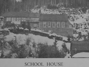 direction we had come from was east we
 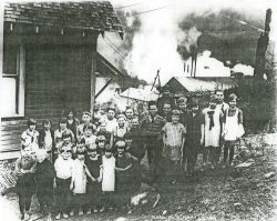 reached the newer part of the school first. Mark quickly recognized the "slate" as concrete and showed me how it was used to form the inside walls of the school. Mark tried to convey to me how it felt to stand where his grandmother and great-aunt had stood more than 80 years before as they taught the children of Alpine. While we were at the school, Mark's sister called. Cell phones sometimes work in Alpine, and this time Mark's did. Mark told his sister that she had to see the town, or at least the memory of it written in concrete and iron on the side of Mr Sawyer - maybe next Spring. We examined the 3 foundations of the school group - the 2 rooms of the school and the 3rd building, teacherage or gymnasium or whatever it might be. This 3rd building caught Mark's attention. The construction is similar to the construction of the 2nd room of the 2-room school: concrete foundation, concrete floor, and concrete inner walls over chicken wire. The difference is that the quality of the concrete work in the 2nd room of the school is much superior to the concrete work on this 3rd building in the school group. It looks as if they ran out of concrete and stretched it. Mark pointed out how difficult (and amazing) it was that there was concrete here at all. This was a lumber town; we should expect that buildings would have been built of lumber on posts. Most lumber towns disappear into the forest again and leave virtually no trace of themselves because they are constructed of the forest and fade back into it over time. Here we had permanence bought with hours of heavy labor. The first problem was that concrete would need to be carried uphill 200 feet from the railroad. The second problem was that the concrete would need to be mixed and used at the site, mixing it somewhere else just wasn't practical. It
 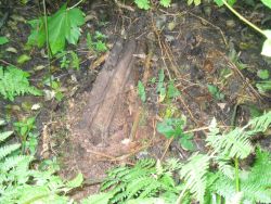 appears that, in the case of the 3rd foundation, they just ran out of concrete and made do with what they had. Whether that 3rd building is the superintendent's house, the teacherage, or gymnasium will await future investigation.
Working our way down the hill, I pointed out the coal stove that we had found in May. Mark pulled it upright to photograph and immediately saw the threaded fittings where pipes had gone from the stove. He showed me and said that it indicated pipes, probably a steam or hot water heat system for the school. While Mark took pictures I rummaged around in the underbrush and found a rusting radiator, half buried in the ground. Proof that Mark was right. The school was built of concrete, had electric lights, and had a coal-fired, hot water heating system. It was a very modern school to have been built in the 1920s in a lumber mill town, high in the Cascade Mountains of Washington.
My bee stings were hurting more by the minute. I moved back down to the railroad tracks to look for Bob. Mark stayed in the forest northwest of the school. While I was finding Bob near the mill, Mark found the foundation of another building, probably one of the two houses that are between the water tower and the school on the 1922 map. I was now sore enough from the bee stings that I wanted to go home. I collected Mark from his explorations, gathered up Bob, and found Brian, who had by now cleared nearly 50 feet of the foundation of the mill. By the mill we picked up a brick to take to Mark's dad in Snohomish. Unfortunately we forgot the brick when we reached the Cascadia and it is still in my car. This was the first time that Bob had been back to Alpine since 1931, and, though we didn't know it, it would be the only time. Bob recorded his memories of Alpine for Nancy Cleveland in September, and died suddenly on October 31, 2009. By such a small margin did we become acquainted with Bob and his knowledge of Alpine. I am deeply sorry that he and I didn't have the opportunity to talk more.
Alpine Annual Reports
The Skykomish Museum has a small amount of information about Alpine. Among the documents at the museum are 6 "annual reports" of the Nippon/Alpine Lumber Company. The first three reports, dated 1917, 1918, and 1919, are for the Nippon Lumber Company. The reports dated 1920, 1925, and 1926 are for the Alpine Lumber Company. The post office was named Alpine from the beginning in 1910, the depot was renamed Alpine in 1914, and the lumber company was finally renamed Alpine in 1920. These are not annual reports such as an investor would receive today from Microsoft or Seattle Genetics. The reports were given to the attendees at the annual Thanksgiving banquet. In Alpine the annual banquet was usually held in December. The annual reports included the menu for the banquet and the program for the banquet. The reports also included  information about how the year had gone, including major events for the mill and the town. And there was what we might consider the local gossip - who was married, who had a baby, who died, when the last snow fell, and the first snow (one year those 2 events were only about 6 weeks apart), and who moved away. The name of every employee, every student, every member of the Red Cross Auxiliary, every member of the cast of plays put on by the local theatre group, are all in the annual reports.
The annual report from the 7th annual dinner on December 1, 1917 starts with a history of the mill and town. It says that the first mill went into operation in April 1910, one month after the tragic avalanche that claimed at least 96 lives in Wellington across the valley. The first mill burned on June 3, 1913. The 2nd mill was constructed in 30 days, and was in operation 33 days after the fire, on July 6, 1913. The next year, 1914, there was a fire in the slashings left by the company's logging operation. "The fire swept up the valley and threatened to again destroy the mill. Heroic work on the part of the crew saved the mill and the major portion of the logging equipment, but the bridges on the logging railway were destroyed and a heavy loss incurred." 24 After that experience the company burned the slashings as close behind logging operations as possible. On July 18, 1917 the 2nd mill burned. The United States had entered World War I in April, 3 months before the fire. Because of war requirements it was more difficult to get 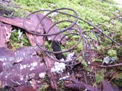 materials to rebuild the mill, and it didn't return to operation until September 21, 1917. The 3rd mill was built with an automatic sprinkler system to reduce fire risk and insurance cost. The 3rd mill survived to the end of habitation in Alpine, and beyond, until it was scavenged for materials during World War II. Maps of Alpine from 1926 and 1930 show that the town had at least 5 fire hydrants. 4 of the hydrants were near the mill, and the 5th was next to the boarding house/post office building. Water for the sprinkler system and the hydrants was supplied by a pipe that carried water from the dam above the town. The pipe was made of wood, wrapped in wire. Bill Carter found a section of pipe in the woods east of Carroll Creek in May 2010, and I found some of the wire near the location of the dam in May 2011.
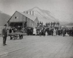 World War I dominated the information in the annual report in December 1918. In May and June a "Victory Hall" had been constructed near the railroad tracks. When a troop train was delayed on the siding at Alpine, the soldiers could get off the train and visit the "Victory Hall". There was a Red Cross office, a dance hall, a billiard room, and a bar. Alpine greatly exceeded its quotas for War Bonds and Red Cross giving, and the Washington Patriotic Committee awarded Alpine a large American flag on July 4 in recognition of the support that Alpine had given to the war effort by buying war bonds. . In 1919 there was information about a new bunkhouse that was going to be built at the 2nd Alpine camp, about 2 miles west and a half mile north along the Tye River at an elevation about 500 feet below the main town of Alpine. The drawings and front elevation depict a handsome 3-story building. I don't know if it was ever built. It would have been a residence for single men at an appropriate distance from the families that lived near the mill, and, incidentally, an appropriate distance from the teenage daughters of those families. In the 1919 annual report an American Legion post had been applied for as the Claude Shatswell Post of the American Legion, Stte of Washington, Number 86. Claude Shatsworth, for whom the post was named, from Alpine, had been wounded and decorated in World War I. In the 1920 annual report there are 25 members of Post 86. I don't know what happened to Post 86 in Alpine after 1920. The number 86 was assigned to Post 86, Peace Arch Post, in Blaine, Washington in 1922. 25
2nd Winter
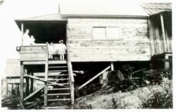
The winter of 2009/2010 started as though it would be like the 2 winters that preceded it. Then the weather turned warm, the warmest January ever. We were able to go to Alpine often. It was cold enough and wet enough that we didn't get much exploring done, but we did take a number of photos. But it was an old photo that caught everyone's attention. Terry Wells of Granite Falls contacted me in early March with this email:
"Good morning Tim. My name is Terry Wells and I thought I would share this with you, since you wanted some information. It's not much, but my Mom who's name is Marjorie Aydt, told me that her Father (my Grandfather) use to be a saw sharpener and travel from one lumber camp to another sharpening the saw blades. She told me as a little girl Grandma would bake cookies and as the troop trains of WW1 would go through Alpine, Grandma, mom and her sisters would throw cookies to the troops. As a side note, when I was a little boy Mom took us up to Alpine, at that time as now there was nothing there, but the remains of some old building and wooden side walks. The forest did a good job reclaiming the old town. Some of the stuff you wrote about, I remember mom talking about, so I find this pretty interesting. I hope this helps in a small way. Thank you"
I looked through the annual reports and found Terry's grandparents. Martin was listed in the 1917 annual report as a "filer", which matched Terry's description that his grandfather sharpened saws. Mrs Aydt was a member of the Red Cross Auxiliary. I let Terry know. 6 weeks later Terry found a photo from Alpine and sent it to me with this note:
"Good afternoon Tim. We looked around the house and found a picture of Mom in Alpine. On the back of the picture it says, "Aydt House Alpine, Harriet Aydt with daughters Kathryn, Margie and Babe." I think Mom is the one in the middle."
The photo is an absolute prize. It is a picture of a family at home on their porch in Alpine. It is unlike every other photo previously found because all of the others were taken by the railroad or for the railroad, or by the lumber company or for the lumber company. This is the first "domestic" photo of Alpine that has turned up.
When we finally went back to Alpine in early May, 2010, 8 descendants of the Aydt family joined us in exploring Alpine. Some had come from as far away as southern Oregon. They found a stump that looked very much like the stump in the photo. We thought at the time that they had probably found the location of the Aydt house. But, a few months later Terry found another photo of the girls on the same porch. The photo is taken from inside the porch looking out and we could identify the buildings behind. One of the buildings is the original school. We know exactly where it is, and that gives us a very good idea of where the Aydt house stood. Maybe in 2011 we can find the exact location.
During the early spring of 2011 we received from Bob Kelly at the Skykomish Museum a pair of maps, dated February 1926 and the same map after it had been updated in August 1930. The map shows the location of the filing room, next to the boiler room in the 3rd mill, where Martin Aydt would have worked.
Because the winter was so mild I was in Alpine often, but usually as a tour guide. The Skykomish Historical Society held a 100th anniversary commemoration of the Wellington Avalanche on February 27, 2010. I would guess that at least 400 people were there. Bob Kelly, Gary Krist, and Martin Burwash all spoke; Gary and Martin read from their books. Blue-ize performed their song, The Wellington Train Disaster. After the meeting I took a few folks to the site of the Alpine depot, Where GN superintendent O'Neill had sent the tragic telegram of the Wellington disaster. The next day I was back in Alpine with Karla Bowman, and we visited the Mayor of Skykomish, Fred Black, in his home, a converted Great Northern caboose. Late in March, Brian Harris and I were back in Alpine and checked out an alternate route into the town. The alternate route did require a half mile 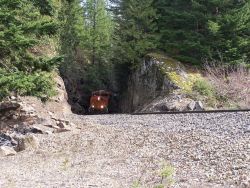 walk west next to the BNSF railroad right-of-way. The grade is just over 2%. Going down the grade into Alpine was easy; we didn't notice that there was any grade. Going back east seemed much harder although you would think that you are walking on flat land. The 2% grade gets to you although you really don't know it is there unless you have been told. Just as we
 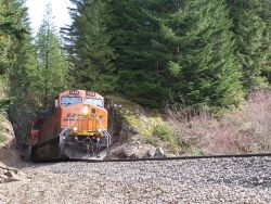 got back to the truck we heard the faint noises of a train coasting downhill through the Bonneville cut. I grabbed the camera from Brian. The angle of the sun was such that I couldn't see anything on the viewfinder. I just held the camera and aimed in the general direction. The train photos are 2 of the best I have ever taken so I think that will be my technique in the future; it is probably better if I don't see what I am aiming at. Since trains are always at least 10 minutes apart, I used the opportunity to walk east through the Bonneville cut. There are safety indentations, large notches, blasted out of the rock. Those indentations would have been put there to protect workers maintaining the railroad right of way. If a train caught workers in the Bonneville cut, they could get out of the way by using the safety indentations.
Brian Harris, his dog Happy, and I went back to Alpine the next week, on the 3rd of April. Winter had finally arrived in Alpine. There was about 6 inches of fresh snow and it was snowing hard. Happy loved it. I tried to take some pictures, but the results were terrible. Brian did get some nice shots of Mt Baldy in the snow, and of the mill foundation wall. The snow was too late to beat down the brush very much, but we went ahead with plans for the big group visit to Alpine in May.
2nd Spring
On May 1, 2010 we were back in Alpine. 18 humans and Keesha The Wonderdog gathered at the Cascadia Inn in Skykomish. As noted in the previous chapter, 8 descendants of the Aydt family were with us. Pat Burns brought his faithful crew from Alpine Pursuit. Bill Carter brought 3 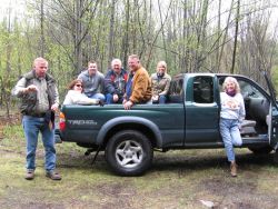 friends. Pat took several photos and 3 videos. Matt Cawby and Keesha, and Brian Harris and I made up the balance of the contingent. There to greet us was the newly appointed Mayor of Alpine, Dave Campbell. The owners of Alpine, Bill and Toni, had given Dave permission to live on the property in his trailer. I, acting by the power I had given myself, appointed Dave as Mayor. Every town needs a mayor, and Dave was really the only candidate.
Alpine is divided into quadrants by the railroad and Carroll Creek. The mill is in the Northeast quadrant, east of Carroll Creek and north of the BNSF railroad. The post office/boarding house, the "Victory Hall", several "shacks" and the road and telegraph line to Alpine 2 are in the Northwest quadrant, west of Carroll Creek and north of the railroad. The Southeast quadrant is most noted for the 1927, 60,000 gallon railroad water tank and we didn't know that existed on any map in our possession in 2010, but this is also an area where we had noticed a garbage dump near the creek. The Southwest quadrant seemed the most promising for new information because it is the location of the depot, the original 1892 water tower, the school, and more than a dozen houses. The north quadrants are on the slope below the railroad; the south quadrants are above the railroad. I split us into 4 uneven teams. I assigned the 8 Aydt descendants to a team with Matt Cawby and his dog Keesha. The reason 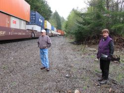 was simple, Matt was the most experienced person in the group and the others had never seen Alpine before. They took the Southwest quadrant where we hoped to find the location of the Aydt house. Bill Carter and his friends took the Southeast quadrant, which had the potential to be the least productive area, but they willingly went. Pat Burns and his crew took the the Northeast quadrant, nearest the mill. Brian Harris and I took the Northwest quadrant where I hoped to find evidence of the telegraph line and road that went from Alpine to the Alpine 2 camp along the Tye River.
The crew in the Southwest quadrant found a stump that looked like the stump in the Aydt family photo. We hoped at the time that they had found the location of the house. A few months later Terry found another photo of the Aydt girls on the porch of their house. The original Alpine school is visible in that photo behind the girls. From that photo we deduce that the stump we found in the Spring of 2010 was not the stump where the Aydt house had stood. Their house would have been 250 to 300 feet further east and down the hill a little from the school. Hopefully another year we will be able to 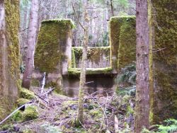 find the exact location. Bill Carter's group in the Southeast quadrant located a section of the original wood, wire-wrapped pipe that had carried water from the dams above Alpine to the railroad water tanks, to the turbine that produced electric power, and to the homes and buildings of Alpine. The lower dam had been built in 1892 for the railroad water tank. In 1927 another, larger dam had been built about 500 feet above the the first dam. The principal reason for the second dam was a 60,000 gallon water tank that the railroad built about 500 feet east of the Alpine Lumber Company mill. According to 1929 and 1930 maps of Alpine there were 5 fire hydrants in Alpine. The Carroll Creek dams would have supplied water to the fire hydrants also. I admit great surprise to discover that Alpine had fire hydrants.
The crew in the Northeast quadrant didn't find much new and soon joined the group in the Southwest quadrant. In the Northwest quadrant Brian Harris and I were looking particularly for the line of telegraph poles that ran from Alpine to the second Alpine Lumber Company camp along the Tye River to the northwest of the mill and houses. The difficulty of finding anything in an overgrown, 3rd-growth forest was certainly evident in our quest. We found one pole that had fallen down, but didn't find any others for at least an hour. The poles would be more than 80 years old, and wood rots; but 2 years before I had seen 3 telegraph poles at Corea, across the valley and at about 500 hundred feet higher elevation. We were tired and ready to quit when I realized that the "tree" 3 feet to my right wasn't a tree at all. I had walked by the "tree" at least 3 times; the "tree" was one of the elusive telegraph poles. By then we were too tired to follow the probably route back down the hill to Alpine 2. It became another project that would need to wait for a better day.
Brian headed back to the truck to wait and I went off to "herd cats". I had 18 people and one dog wandering the property at Alpine, and I was responsible for their well-being and it was my responsibility to be certain that they all found their way home again. That took most of an hour. We hadn't lost anyone. The group compared notes; the workbooks were turned in for Brian to map the locations where things of interest had been found. I couldn't stop at the Cascadia that day. I had a social engagement in Seattle that evening. Bad scheduling on my part, but my date (in her little black dress) was the most breathtakingly beautiful woman at the gala. She made foregoing a Cadia burger a little more acceptable.
I only got back to Alpine one more time in 2010. Brian Harris and I went back in July to check the tags and GPS coordinates that the 4 teams had generated. Then Brian mapped the finds and superimposed the GPS points on a copy of the 1922 railroad map of Alpine.
3rd Winter
Winter 2010/2011 was a mixed up chaotic challenge. Winter came and went and came back again. At one point we worried for 3 weeks about the safety of the "mayor" of Alpine. Snow had come quickly and very deep, we couldn't get into theproperty, and we couldn't reach the "mayor" by phone. No one in Skykomish had seen him. We ultimately learned that Dave had been off the property when the snowstorm hit and couldn't get back in. He stayed in Snohomish, 40 miles away, until conditions improved enugh for him to go in on his newly purchased snowmobile.
Because the the weather warmed and chilled again, and snow fell in great quantities but also melted in torrents, it was difficult to decide when the first expedition of the year would be. Brian Harris, Paul Webber, Maggie Daheim and I went on April 2 to check the snow conditions. The road was snowy and muddy, but drivable for a 4-wheel drive. Brian and I went back on April 23. Brian and Happy drove into Alpine and I walked. Brian dropped me off at the bottom so that I could walk in and assess the road condition for the first large spring visit. The road was drivable but at such a low pace that I nearly kept up with Brian and Happy. They had just gotten out of the truck at the midpoint to wait for me when I came into view. I went ahead on foot while Happy ran for a few minutes. Then Brian and Happy passed me at the fork in the road that leads to Carroll Creek or Alpine. I arrived at the mill about 2 minutes behind them. There was one place where the road had washed out some, but we decided that it was passable for the Spring visit to Alpine, but it was going to require a 4-wheel drive.
3rd Spring
Our 3rd spring visit to Alpine had fewer people than we had the 2nd year. Maybe interest in Alpine is fading. We went in on April 30, 2011. Matt Cawby recorded the event for posterity, following me into Alpine and making editorial comments on the way. I was able to maneuver my Kia into Alpine, the only non-4-wheel drive car in the caravan, and the last time I will drive a 2-wheel drive car into Alpine. The road is just too rough, rutted, rocky, and usually wet. I had not intended to drive into Alpine, but Brian Harris' 4-wheel drive truck had wound up in the shop at the last minute and my van was forced into service. I ddin't expect to get all the way in and I wanted to go last in the caravan so that I wouldn't impeded the progress of the others. Matt and Donna insisted that they would go last to retreive me and my passengers if (or probalby when) I got stuck. If you listen carefully to Matt's comments on the video you can hear him say to Donna, "Tim's not gonna get up that hill" at the last incline. I did get up the hill; I also got stuck for about 2 minutes on the way. Matt didn't get that on video because they were waiting at the bottom of the last, steepest incline, expecting me to come rolling back down the hill. This would have some unhappy consequences for another 2-wheel drive vehicle about 10 weeks later.
There was still snow in the upper town and many of the participants were unprepared for snow. We only stayed a couple of hours and didn't find anything new. But that was the beginning of near-weekly visits by some of us. Paul and Maggie were back there a week later. Matt, Donna, and Keesha soon after that. Brian, Happy, and me later in May. Then Paul and Maggie, and Matt, Donna, and Keesha again. Then the Corcorans. Matt set up an Alpine blog to track his multiple visits to Alpine. He has posted videos on youtube; check out The Road to Alpine and BNSF 4989 taken that day, and others taken in the weeks following.
On these visits to Alpine, Matt found the remains of the 1927-era 60,000 gallon water tank that the Great Northern Railway had built. I climbed Carroll Creek past the location of the 1892 dam and photographed what I saw; I didn't get to the location of the 1927 dam. That day I was hiking by myself and decided that the risk/reward ratio was against me, but I hope to get back up there before the year is out. Matt and Donna located the Alpine shingle mill and marked the corners of where Matt believes the foundation of the saw mill is hiding under dirt and vegetation. They continued the 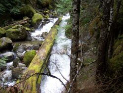 clearing of the saw mill near the boiler room that Brian Harris had begun 2 years before, and found a number of artifacts.
But with all this activity we had a recurring problem. Our searches this year had taken us east toward the bend in the railroad, and nearer to railroad property. There were 3 occasions where incautious Alpine explorers found themselves uncomfortably close to westbound trains that appeared suddenly around the bend east of Alpine. I have empasized this before - westbound trains are dangerous - westbound trains are quiet. The train crews are surprised to see someone on the tracks. They probably couldn't stop the train in 5 miles if they had to because of the steep downhill slope and the thousands of tons of train behind them. If you are in Alpine, avoid the railroad tracks. If you must cross the tracks to get to the upper town, get across the tracks quickly and get out of the way. The BNSF railroad through Alpine is the main east-west railroad in the Northwest. Alpine may be a ghost town, but the train tracks are very much alive. BNSF has installed new track signals this year. Those signals will, if visitors pay attention to the signals, give early warning of trains coming. The signals are dark if there are no trains or inspection vehicles "in the block". I don't know the size of the "block", but I think it probably goes at least 3 miles east to Scenic and 4 miles west to Foss River. If the signals are on, it doesn't matter whether red or green, expect a train in ten minutes or less and, please, stay out of the way.
On the trip in late May I also hiked west from Alpine toward the railroad bridge that can be almost seen from the middle of Alpine.The distance is about a half mile. After about a quarter mile I walked off of the private property that includes Alpine and walked into National Forest Service land. The change is instant and evident. Alpine is characterized by weeds and slash from the last, sloppy, logging operation in 1992. The Forest Service land is just that, forest. I walked west and discovered that the "bridge" was actually a trestle over a deep ravine formed by a small stream, a much smaller stream than Carroll Creek and I haven't found its name on topo maps. I didn't have the camera. The ravine is beautiful, and the waterfall of the stream tumbles into the ravine in the Spring. Framed by the railroad trestle, built in 1906, the ravine is almost grotto-like.
Ghost towns of Washington
In July 2011 Tim Nyhus of www.ghosttownsofwashington.com contacted me about Alpine. I supplied as much information as I could. On July 15 he posted that he would be going into Alpine the next day. Matt Cawby also posted information about the exploring he had done the previous weekend and that he had marked the corners of the mill. I decided late Saturday morning that I would go to Alpine. I hadn't been there in 7 weeks. I intended to park at Alpine Falls and walk in.
I had intended to be in Oregon that day, but my schedule had changed. On the drive to Skykomish I remembered that it was Oldtimers weekend. I stopped at the baseball field in Skykomish where the Oldtimers picnic is held. I talked to a few of the folks from the Skykomish Historical Society and asked them to get names and phone numbers if any old Alpiners showed up. Then I went my way to Alpine Falls. I got out of the car and ran across the Tye bridge to the road to Alpine. I never got to Alpine. Atop the massive rock at the beginning of the road was Tim Nyhus. He had seen the video of me driving into Alpine in my 2-wheel drive van and had tried it himself. He didn't make it. His van wound up impaled on a rock, compounded by transmission and other problems. Tim had walked into Alpine for a brief visit and then had walked back down to highway 2 to get a cell signal to call his wife.
It was going to be hours before his wife could get to Alpine. We used the time to visit Wellington, Cascade Station, and other sites in the upper Tye/Skykomish region. We photographed what was left of the old outhouse that had been used by the Alpine souvenir stand in the 1940s. We visited the remains of the old trestle that had served the Bloedel-Donovan mill railroad in Skykomish. We helped 2 kayakers who had pulled out of the Tye River just above Alpine Falls. They had decided (I think very wisely) to get out of the river rather than run Alpine Falls. A kayaking site says of Alpine Falls, "There are very few eddies above this fifty foot, two tiered waterfall and it will probably kill you if you end up on the river right side of the falls. I have run Alpine Falls once, but I don't recommend it." 26 We returned one of the kayakers to their truck so they could collect their kayaks and equipment. We wandered around Skykomish, met the mayor and, separately, 3 council members. Tim took photos of the old Skykomish depot and the school. He was especially charmed by the school, both for the character of the design and that it is still a school. Most schools of that vintage are now museums or community centers. I took him to dinner at the Cascadia; in spite of my diet I had a Cadia burger (I only get one every couple of months). Eventually we met his wife in Monroe. Within a few days he had Alpine, Cascade Station, and Wellington on the web site at www.ghosttownsofwashington.com. He has also posted photos of the Maloney store in Skykomish (which hopefully will soon house the Skykomish Museum) and the Skykomish Hotel.
Alpine/Nippon
One of the ongoing arguments about Alpine is that the original name, Nippon, was chosen because there were Japanese workers in Alpine who worked for the railroad or who worked for the mill. I have found no evidence of Japanese workers building the original Great Northern Railway. The place name listing, apparently put together by Edmund Meany, at the Tacoma Public Library says this about Nippon, "A sawmill community east of Skykomish in the northeast region of King County was named Nippon near the beginning of the 20th Century. One of the mills employed a number of Japanese workers although an extant photograph of one crew has no Japanese represented. The name was changed to Alpine in January of 1915." 27
I find just about everything in that "official" quote to be wrong, except the acknowledgment that there are no Japanese in existing photos. The original depot was named Nippon in 1892. There was only one mill company in Alpine/Nippon. There are numerous surviving photos of workers and families in Alpine; several of those are in this document. There are no Japanese or other Asians in any photos. There are no Japanese names in the annual reports of 1917, 1918, 1919, 1920, or 1925. Annual reports for 1923 and 1924 were donated to the Skykomish Historical Society in mid-2011. I haven't yet seen those, but I have seen excerpts of those reports posted on Matt Cawby's Alpine Blog. Again there are no Japanese names listed or Asian appearing faces in any of the photos. I don't have annual reports from the other years, but I expect they would be similar. As you have read earlier in this document the depot was renamed Alpine in February 1914 after a request by Carl Clemans to reconcile the name of the post office and depot both as Alpine to mitigate the then continuing confusion with the Nippon Post Office Station in what is now called the International District of Seattle. But there is no evidence as to why the Great Northern Railway chose the name Nippon in the first place. I don't know how many depots the Great Northern had, but it must have been a major chore to just come up with names for all those depots.
There also do not appear to be any Japanese names recorded in Great Northern Railway records in the 1890s. Japanese begin to appear in the Skykomish/Tye valleys in the 1910s and there were certainly many in the 1920s. Workers of Japanese ancestry certainly worked for the Great Northern in the 1920s. Japanese lived in the valley until 1942, when they were taken to internment camps. They lost just about everything they had worked for, and, mostly, never came back. The character of the upper Skykomish Valley changed with that loss. I am not aware of a site in the Sky Valley that commemorates the Japanese internment, but there is site on Bainbridge Island at Joel Pritchard Park that is well worth the ferry trip to learn about that dark time in early 1942when Japanese-Americans were taken from their homes and businesses because of their ancestry.
Fires
The Winter and early Spring of 2011/2012 brought fire to buildings that are closely associated with Alpine. Early Christmas morning fire burned much of the old church in Startup that had become a gallery for the owners of Alpine. No one was hurt but fire destroyed what had been the sanctuary and steeple of the 100-year-old church structure. On April 10 fire struck again. This time at the Whistling Post Tavern in Skykomish burned. Early reports indicate that it was an arson set to cover a robbery of the ATM in the building. Irreplaceable photos and railroad relics were lost. This was another 100-year-old building. the building had been built by Paddy McEvoy, one of the first engineers on the Great Northern Railway in the Northwest. Teddy Jo Ryder, the owner of the Whistling Post, had been instrumental in a donation of Alpine items that were given to the Skykomish Historical Society only 6 months earlier. The church in Startup has been partially rebuilt. At this time I don't know whether the Whistling Post will be rebuilt.
Notes
Avalanche
1 Passage and quote are from Roe, JoAnn Stevens Pass Gateway to Seattle, page 125
2 Quote is from Daheim, Mary The Alpine Advocate, Dedication
3 Quote is from a letter in the Jim Frederickson Collection from C. L. Clemans, Postmaster, to M. J. Costello, Traffic Manager, dated November 15, 1913
August Visit to the Ghosts of Wellington and Cascade Station
4 Quote is from Sherman, Fr William Railroads, and their influence on the Settlement and Social Development of the Northwest, page 7, Great Northern Goat #138, March 2009
5 Quote is from Krist, Gary The White Cascade, page 56-57.
6 Interview with Joni Schinske, May 28, 2009
The Remarkable Carl Lane Clemans
7 Snohomish County Tribune, front-page obituary for Carl L Clemans October 9, 1941
8 The Alpine Lumber Company Menu and Annual Report, Fifteenth Annual Thanksgiving Festival and Dinner, December 5, 1925
9 Sports Illustrated Vault November 1954
10 San Francisco Chronicle March 19, 1892 reprinted in San Francisco Chronicle November 21, 2004
11 Quote is from Altenberg, Lee, Ph.D. Application to Register the Beta Chi Chapter House of Sigma Nu, Stanford University (Synergy House Since 1972) As a Point of Historical Interest May, 1991 4th paragraph, 3rd sub-section titled "ON THE HISTORICAL CONTRIBUTION OF THE BETA CHI CHAPTER OF SIGMA NU:"
12 Lee Altenberg interview with Kate Snitjer (daughter of Carl Lane Clemans) on June 29, 1988
13 Quote is from Altenberg, Lee, Ph.D. Application to Register the Beta Chi Chapter House of Sigma Nu, Stanford University (Synergy House Since 1972) As a Point of Historical Interest May, 1991 5th paragraph, 3rd sub-section titled "ON THE HISTORICAL CONTRIBUTION OF THE BETA CHI CHAPTER OF SIGMA NU:"
14 Quote is from Altenberg, Lee Beyond Capitalism - Leland Stanford's Forgotten Vision Published in Sandstone and Tile, Vol. 14 (1): 8-20, Winter 1990, Stanford Historical Society, Stanford, California.
15 Quote is from the menu and annual report of the Tenth Annual Banquet and Ball, November 27, 1920 for the Alpine Lumber Company
16 Quote is from the menu and annual report of the Seventh Annual Dinner and Ball, December 1, 1917 for the Nippon Lumber Company
17 Letters found in Jim Frederickson Collection
Spring of Discovery in Alpine
18 The Nippon Lumber Company Menu and Annual Report, Annual Banquet and Dance, December 7, 1918
The Man From Georgia
19 Quote is from Daheim, Mary the Alpine Nemesis, Afterword
The Visit of Alpiners Back in Alpine after 80 years
20 Interview with Bob Crawford July 30, 2009
21 The Nippon Lumber Company Menu and Annual Report, Annual Banquet and Dance, December 7, 1918
22 Armbruster, Kurt E Orphan Road Pullman, WA: Washington State University Press, 1999, page 181
23 The Alpine Lumber Company Menu and Annual Report, Annual Banquet and Dance, 1920
Alpine Annual Reports
24 Quote is from the menu and annual report of the Seventh Annual Dinner and Ball, December 1, 1917 for the Nippon Lumber Company
25 http://blaineamericanlegion.com/
Ghost towns of Washington
26 Quote from Albright, Darren The Top Tye
Alpine/Nippon
27 Quote from Tacoma Public Library - Washington Place Names database
Steam.htm
100 From interview with fireman on Durango & Silverton Railroad in July 2001. He said that he had volunteered to become a fireman on the railroad to get in shape and had successfully lost 40 pounds in the process. On the trip up to Silverton from Durango he would shovel 8 tons of coal in less than 4 hours of travel. On the way back downhill to Durango he would shovel only 2 tons of coal. The engine required water at the halfway point on the trip up, but didn't require any additional water on the trip down.
VictoryHall.htm
101 Tjerne, Elsie Interviews July 31, 2009 and September 15, 2009
102 The Nippon Lumber Company Menu and Annual Report, Annual Banquet and Dance, December 7, 1918
Aydt.htm
103 The Nippon Lumber Company Menu and Annual Report, Seventh Annual Dinner and Ball, December 1, 1917
Bibliography
Albright, Darren The Top Tye http://www.oregonkayaking.net/rivers/toptye/toptye.html
Altenberg, Lee Beyond Capitalism - Leland Stanford's Forgotten Vision Published in Sandstone and Tile, Vol. 14 (1): 8-20, Winter 1990, Stanford Historical Society, Stanford, California.
Armbruster, Kurt E Orphan Road Pullman, WA: Washington State University Press, 1999
Brady, John P. The Great Slide Originally published in Railroad Magazine, 1946
Reprinted in "Locomotives of the Empire Builder" by Charles F. Martin, 1972 , now found at http://gngoat.org/wellington.htm
Carlson, Linda Company Towns of the Pacific Northwest Seattle and London: University of Washington Press, 2003
Cleveland, Nancy & Sekor, Anne Upriver Voices, Tales of Skykomish Skykomish, WA: Skykomish Historical Society, 2008
Clemans, Carl Lane Beginnings on the Pacific Coast, Founding of Beta Chi Chapter at Leland Stanford Jr. University 1919
Crawford, Bob Interviews July 30, 2009 and August 15, 2009
Daheim, Mary The Alpine Advocate New York: Ballantine Books, 1992
Daheim, Mary The Alpine Nemesis New York: Fawcett Books, 2001
Kelly, Robert The Wellington Avalanche home1.gte.net/mvmmvm/index.html
Krist, Gary The White Cascade New York: Henry Holt and Company, 2007
McFarlane, Angus The Richmond Grounds and the Big Games of 1902 & 1903
McCormick, Ginny The Hundred Years War Stanford Magazine, November-December, 1997
Roe, Joann Stevens Pass, Gateway to Seattle Caldwell, ID: Caxton Press, 1995
Schinske, Joni Interview May 28, 2009
Sherman, Fr William Railroads, and their influence on the Settlement and Social Development of the Northwest Rockford, Il: The Great Northern Goat No 138, March 2009
Tjerne, Elsie Interviews July 31, 2009 and September 15, 2009
Williams, Buddie A Photographic History of the Towns of Highway2 (Railroad Edition) Startup, WA: Historical Publishing
Letters from the Jim Frederickson Collection
Alpine Archive, Skykomish Historical Society
Great Northern Railway Historical Society Archives
Snohomish County Tribune October 9, 1941
http://www.worldperc.com/comet/faqs.shtml Comet Lodge Cemetery
Sigma Nu Fraternity Hall of Honor
http://www.rootsweb.ancestry.com/~wasnohom/karync.htm
http://savexox.tumblr.com/tagged/history
Interview with fireman on Durango-Silverton Railroad, July 2001
The Nippon Lumber Company Souvenir Menu and Annual Report, Seventh Annual Dinner and Ball, December 1, 1917
The Nippon Lumber Company Souvenir Menu and Annual Report, Eighth Annual Banquet and Dance, December 7, 1918
The Nippon Lumber Company Souvenir Menu and Annual Report, Ninth Annual Banquet and Dance, December 6, 1919
The Alpine Lumber Company Souvenir Menu and Annual Report, Tenth Annual Banquet and Dance, November 27, 1920
The Alpine Lumber Company Souvenir Menu and Annual Report, Fifteenth Annual Banquet and Dance, December 5, 1925
The Alpine Lumber Company Souvenir Menu and Annual Report, Sixteenth Annual Banquet and Dance, December 4, 1926
Tacoma Public Library - Washington Place Names database
The Delta of Sigma Nu Fraternity Volume 36 October 1918 to May 1919
The San Francisco Chronicle November 14, 2004 The Big Game, Part 1, article reprinted from March 19, 1892
The San Francisco Chronicle November 21, 2004 The Big Game, Part 2, article reprinted from March 19, 1892